


Pocket Fire update as of June 25, 2026 7 a.m.
- Acres: 1,187
- Personnel: 927
- Containment: 0%
- Fuels: Timber and Brush
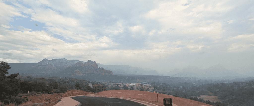
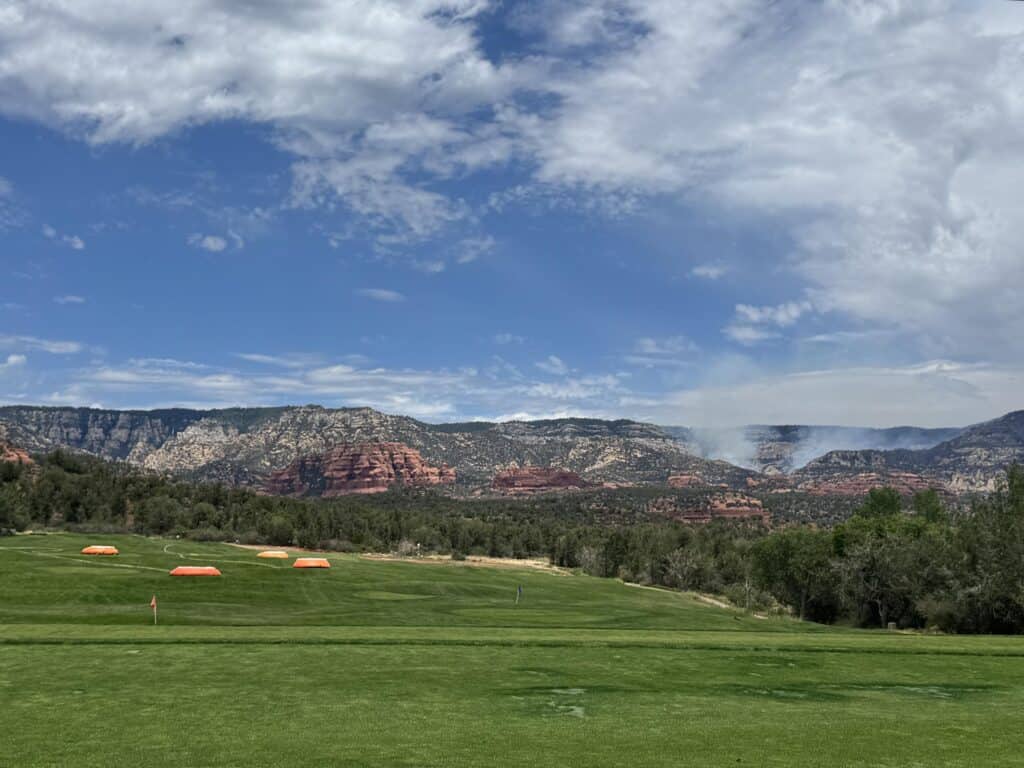
- Location: 7 miles north of Sedona
- Cause: Undetermined

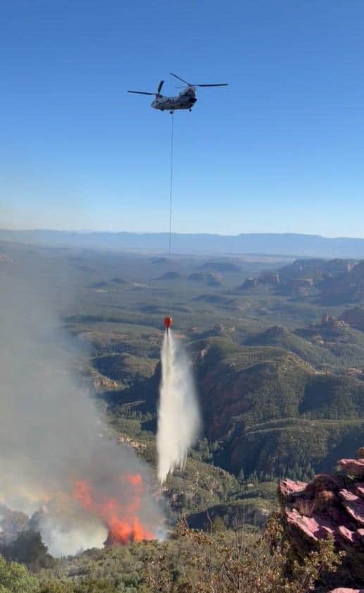
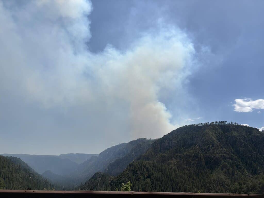
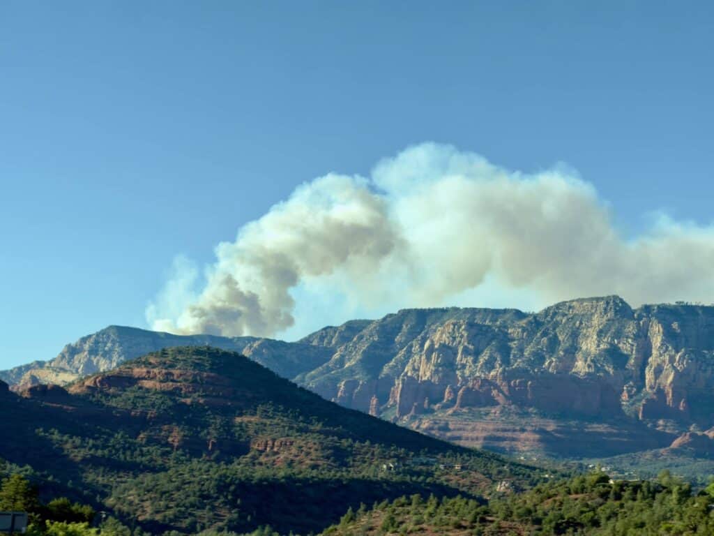
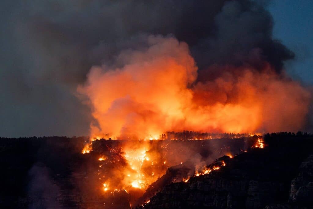
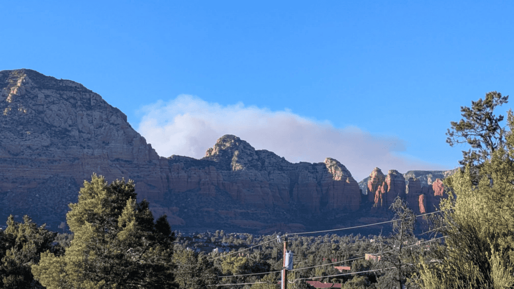
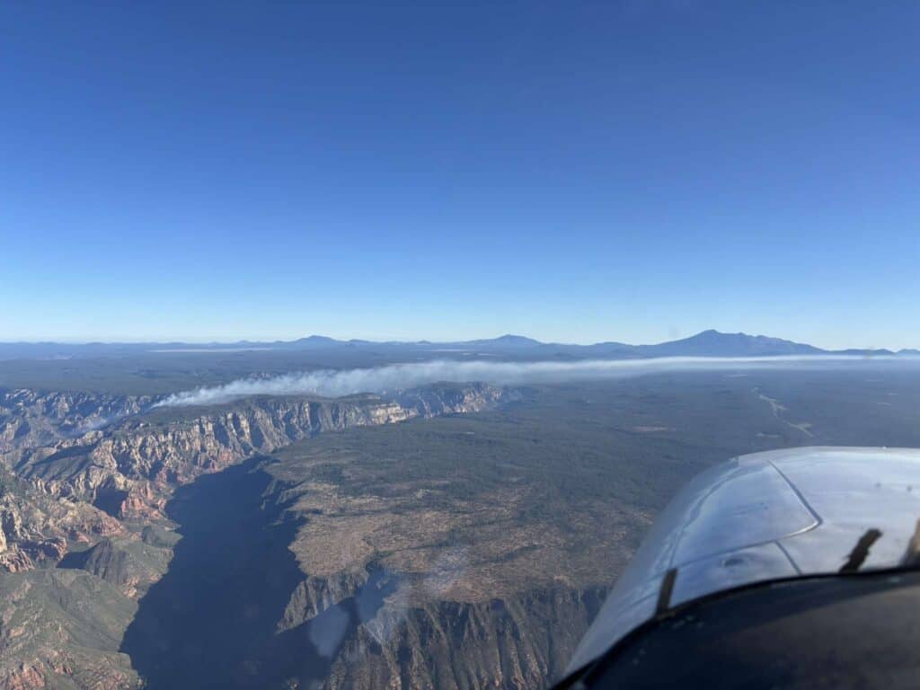
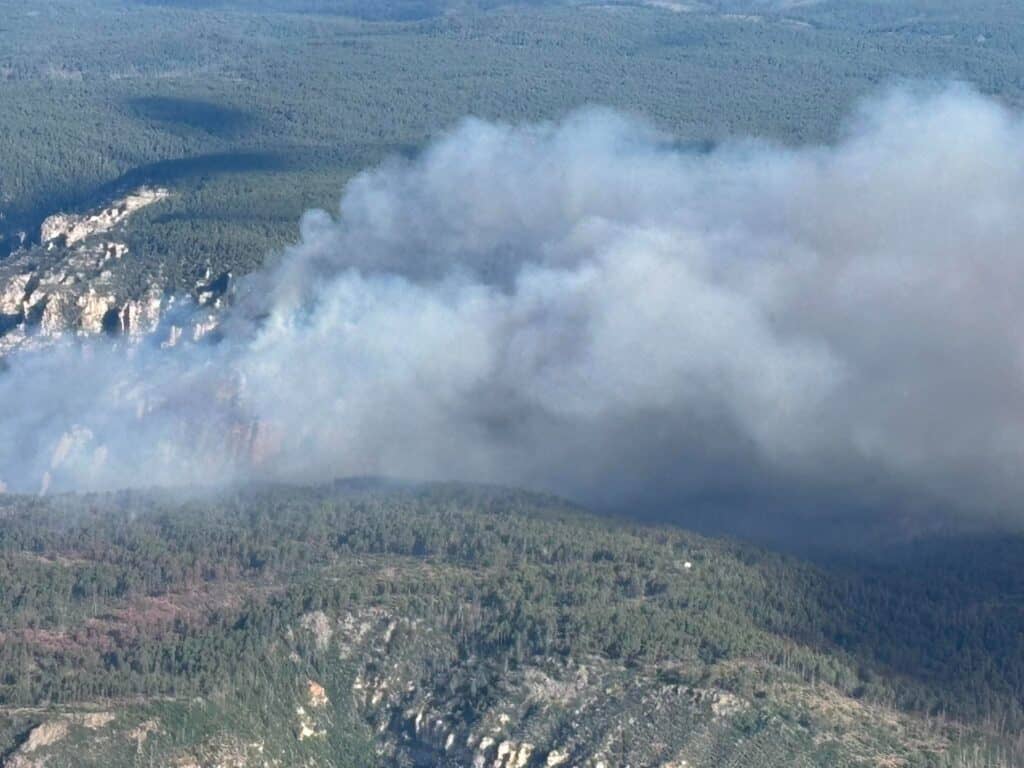
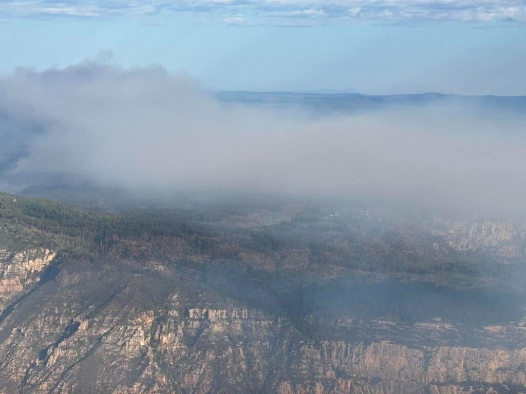
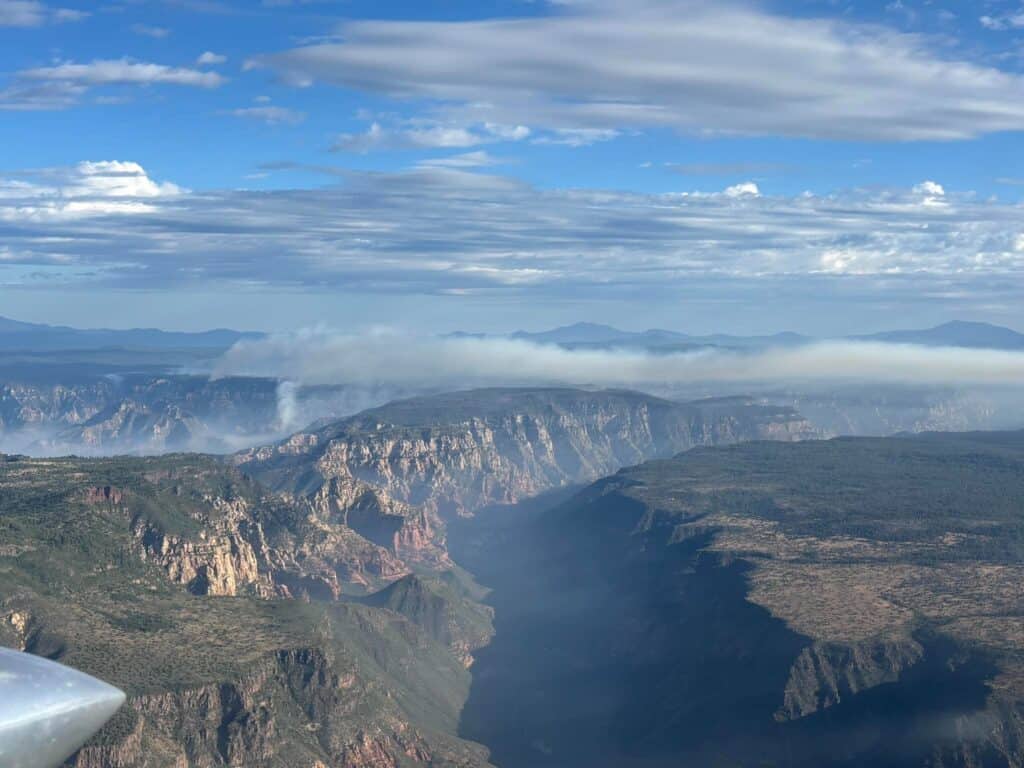
Firefighters conducted firing operations last night, Wednesday, June 24, on the Pocket Fire. These firing operations led to a noticeable increase in smoke production.

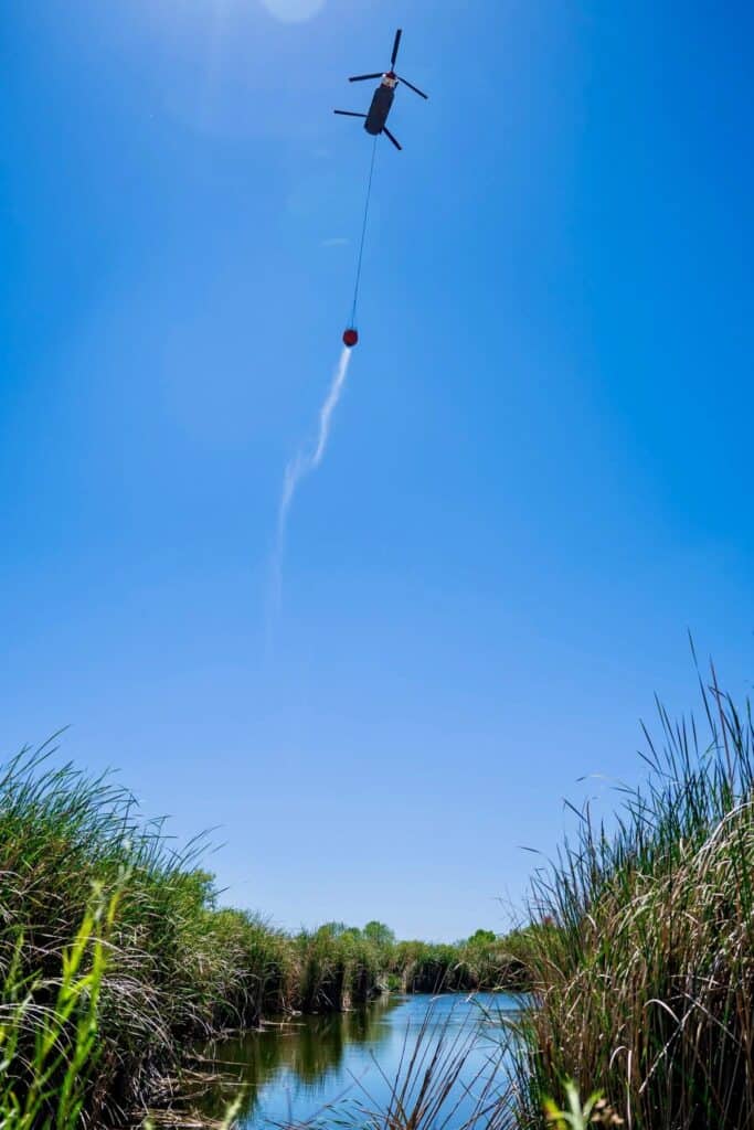
Christopher Fox Graham/Larson Newspapers
Firing operations were conducted along the north edge of the fire, building a catcher’s mitt since it is impossible for firefighters to conduct a direct attack on this fire.
Firefighters plan to continue firing operations today, weather permitting. Fuels in the area have been dried by severe and long-lasting drought. Even after a heavy rain, fine fuels will be dry and receptive to fire an hour after sun exposure. Large diameter fuels would require weeks of rain to change their ability to burn.

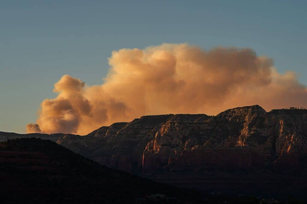
The combination of fuel, terrain and weather ensures that this fire will be on the landscape for some time. While much of the area received light rain showers on Wednesday afternoon, they were insufficient to extinguish the fire. Tomorrow begins three days of extreme fire weather under a Red Flag Warning.

Video courtesy of the Sedona Fire District
Today, Thursday, June 25, crews will continue their work consolidating and strengthening defensive lines in anticipation of the upcoming extreme fire weather. Wednesday’s rain had little effect on the fire’s advance or intensity. While firefighters plan to engage directly when opportunities are available, the hazardous terrain of the Red Rock-Secret Mountain Wilderness makes a direct attack on the Pocket Fire extremely dangerous for firefighters.
A public meeting will be held Thursday, June 25, at 7 p.m., at Sinagua Middle School, 3950 E Butler Ave, Flagstaff. Incident Management Team members and local authorities will speak and be available for questions from attendees. The meetings will be live streamed on the Coconino National Forest Facebook page: facebook.com/CoconinoNF. If you attend in person, please park on the north side of the school.

Why is the Pocket Fire still listed as “0% contained”?
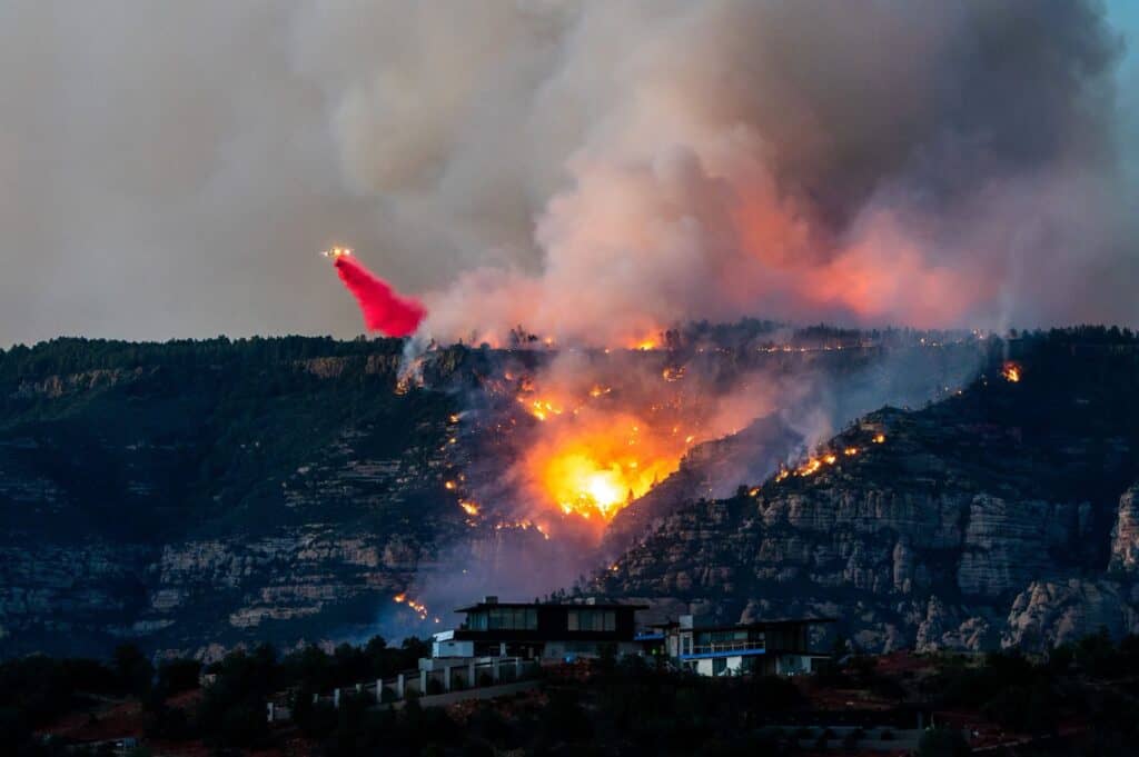
Before fire managers declare part of the fire perimeter contained, they make certain that no sources of heat are threatening that section. Usually, firefighters walk that part of the perimeter manually checking for heat. Additionally, aircraft equipped with extremely sensitive infrared (IR) cameras look for hot spots, measuring how far they are from the edge of the fire. On the Pocket Fire, the extremely tough terrain is preventing firefighters from manually checking the edge. IR flights have been made, but managers are not yet satisfied that any edge can be declared contained. The severe fire weather starting tomorrow will test all the defenses that crews have spent the last few days building.

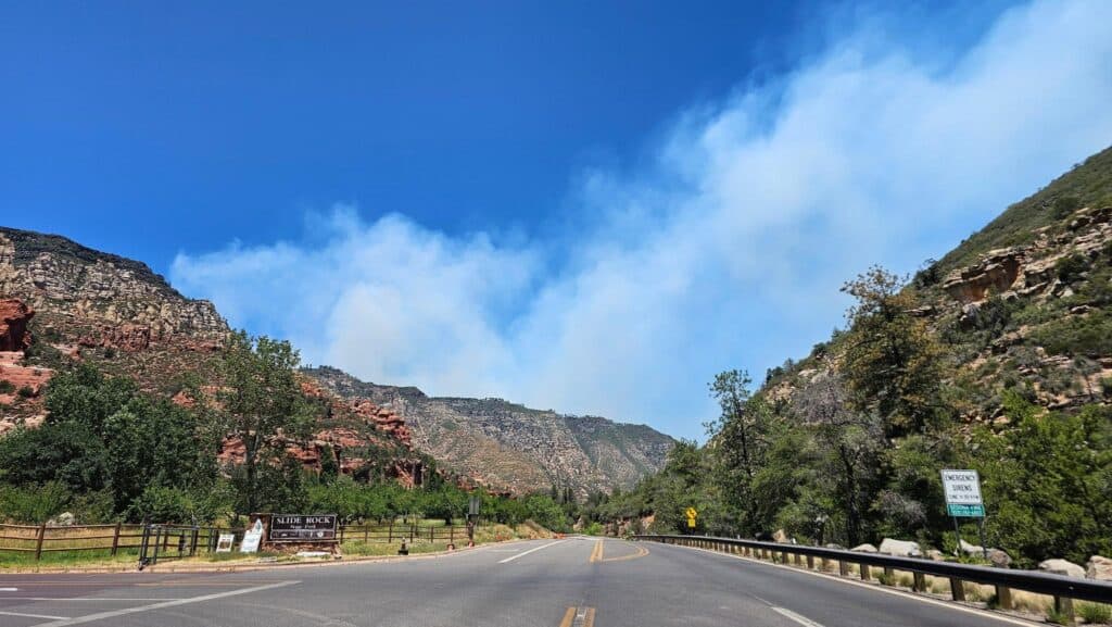
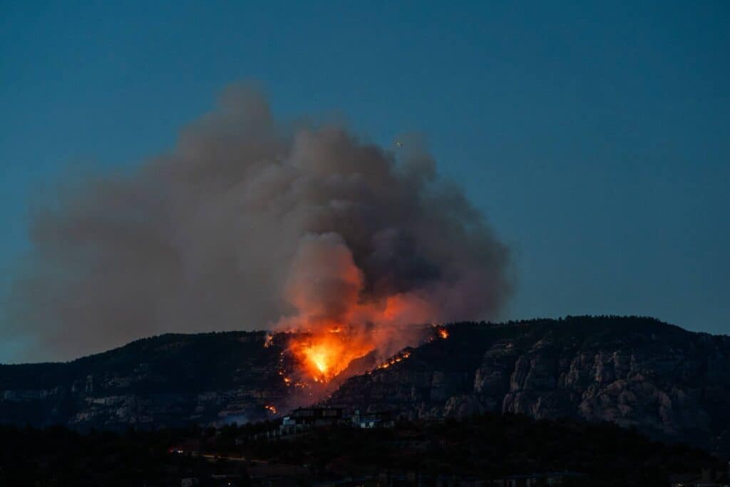
Photo courtesy of A. Reid
Evacuations and Closures
Cococnino County issuesd a “GO” evacation order at 7:17 p.m. on Friday, June 19, ordering residents and visitors out of Oak Creek Canyon between Sedona and Forest Highlands. Sedona police officers closed northbound State Route 89A at Owenby Way at the north end of Uptown while Coconino County Sheriff’s deputies closed southbound State Route 89A at Fort Tuthill. Per Arizona state law, such orders are not mandatory, but are strongly recommended. Those who left the evacuation zone were not permitted to return. Coconino County Sheriff’s deputies provided escorts for homeowners and property owners to enter and retrieve their belongings.


The American Red Cross has opened a shelter at Sedona Red Rock High School in Sedona, 995 Upper Red Rock Loop Road. About a dozen people took advantage of the shelter.
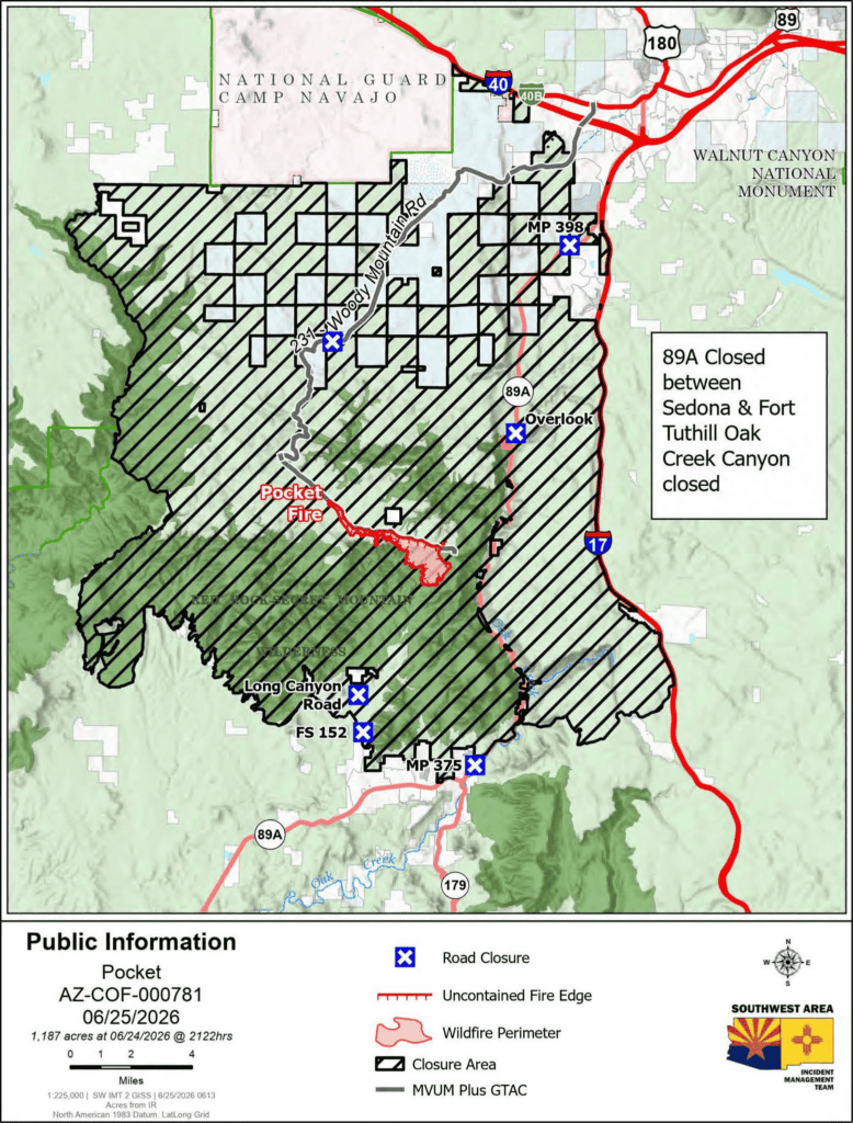
Lake Mary is closed to recreation, due to Pocket Fire aerial support. Woody Mountain Road, aka Forest Service Road 231 is closed starting at the Forest Service Road 536 intersection.
The evacuation order moved from “GO” to “is in “SET” in the “Ready, Set, Go!” evacuation system at 8 a.m., Tuesday, June 23. Oak Creek Canyon is open only to residents who can prove their identity and residency. View the Coconino County Evacuation Map here. If you have questions about the evacuation order, call the Coconino County Sheriff’s office: 928-774-4523. For more information on the READY, SET, GO! evacuation system, visit: ein.az.gov/ready-set-go.
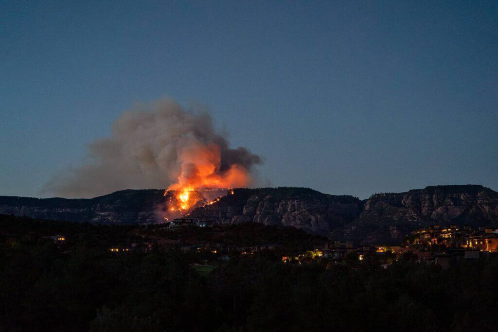
Courtesy photo
State Route 89A remains closed between Sedona and Forest Highlands. For exact road closure locations, visit: az511.com.
A portion of Coconino National Forest around the fire remains closed to the public to ensure safety of the public and firefighters. For more details, including a closure area map, visit the USFS website here.
Video courtesy of the Coconino National Forest
Weather Forecast
High temperatures around the fire today will be between 84 and 95 degrees, depending on elevation. Winds will be moderate, but gusts may reach 30 mph. Humidity will remain very low. Scattered thundershowers are possible, but little precipitation is expected. The National Weather Service has issued a Fire Weather Warning from 11 a.m. Friday through 8 p.m. Sunday. During this time, wind gusts may reach 50 mph and afternoon relative humidity may reach as low as 8%.
Smoke Warnings

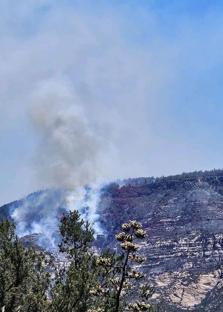
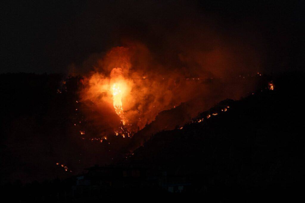
Photo courtesy of A. Reid
Some locations in the area are experiencing air quality that is “Unhealthy for Sensitive Groups.” This can change from hour to hour, so the public should remain vigilant. For more information, visit outlooks.airfire.org/outlook/760194b8. Crews and heavy equipment remain very active on SR 89A. Residents returning to their homes in Oak Creek Canyon should drive cautiously around switchbacks and blind curves as fire traffic and large vehicles will have an increased presence on the road. Slow speeds are advised to ensure motorist and firefighter safety.
Phone Number: 928-260-0543 (7a.m. – 7p.m.)
Email: 2026.pocket@firenet.gov
Inciweb: http://inciweb.wildfire.gov/incident…/azcof-pocket-fire
Facebook: facebook.com/CoconinoNF
Fire History North of Sedona
Sedona Red Rock News readers have asked how the Pocket Fire compares to previous wildfires near Sedona, like the 4,317-acre Brins Mesa Fire in 2006, the 21,227 Slide Fire in 2014 and the 78,065-acre Rafael Fire 2021. The U.S. Forest Service – Coconino National Forest published this Fire History map on Wednesday, June 24, showing these past fires in relation to each other, in addition to smaller fires around Sedona and Oak Creek Canyon.

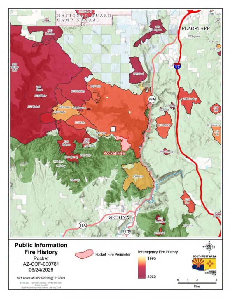
“Recent fires on the landscape surrounding the Pocket Fire play a very important role in fire manager strategy,” the U.S. Forest Service – Coconino National Forest wrote. “Nearby fire scars — such as the ones left behind in the 2018 Platypus and Rhino fires — can help to tamper fire growth and behavior should the Pocket Fire move to the west. These fire scars can be used as part of line construction efforts helping to connect other types of fire line, such as man-made — via shovels, bulldozers and drip torches — and line created by geographic features — like roads and rock outcroppings.
“Other nearby land treatments such as prescribed fire and thinning operations also help to reduce unnecessary fuel loading prior to unexpected and unwanted wildfires.
“There haven’t been a lot of land treatments done below the rim of Oak Creek Canyon because the steep terrain and cliff faces make it incredibly hazardous for prescribed fire and close to impossible for mechanical thinning treatments.
“Check out this fire history map for a visual reference. You can see why intentional low-intensity fire on the landscape is such an important part of long-term fire management strategy.”
Pocket Fire Photo Gallery
David Jolkovski/Larson Newspapers

David Jolkovski/Larson Newspapers

David Jolkovski/Larson Newspapers
David Jolkovski/Larson Newspapers
David Jolkovski/Larson Newspapers
David Jolkovski/Larson Newspapers
David Jolkovski/Larson Newspapers

Christopher Fox Graham/Larson Newspapers

David Jolkovski/Larson Newspapers

David Jolkovski/Larson Newspapers

David Jolkovski/Larson Newspapers
David Jolkovski/Larson Newspapers

David Jolkovski/Larson Newspapers
David Jolkovski/Larson Newspapers
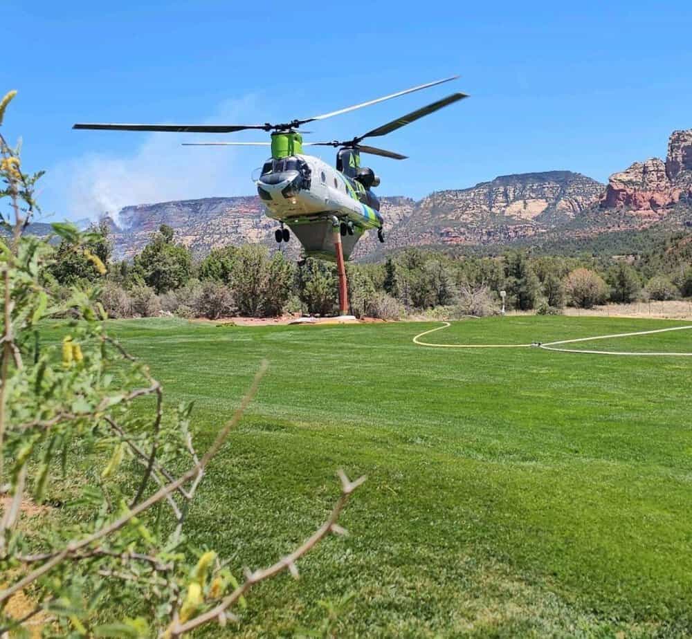
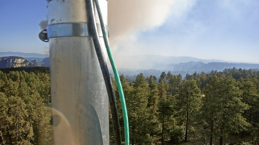
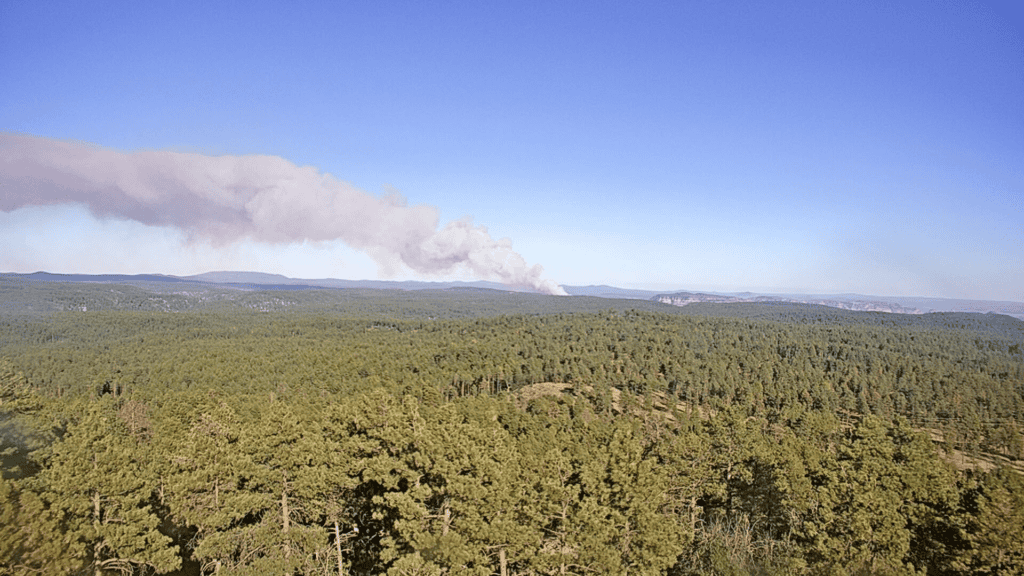
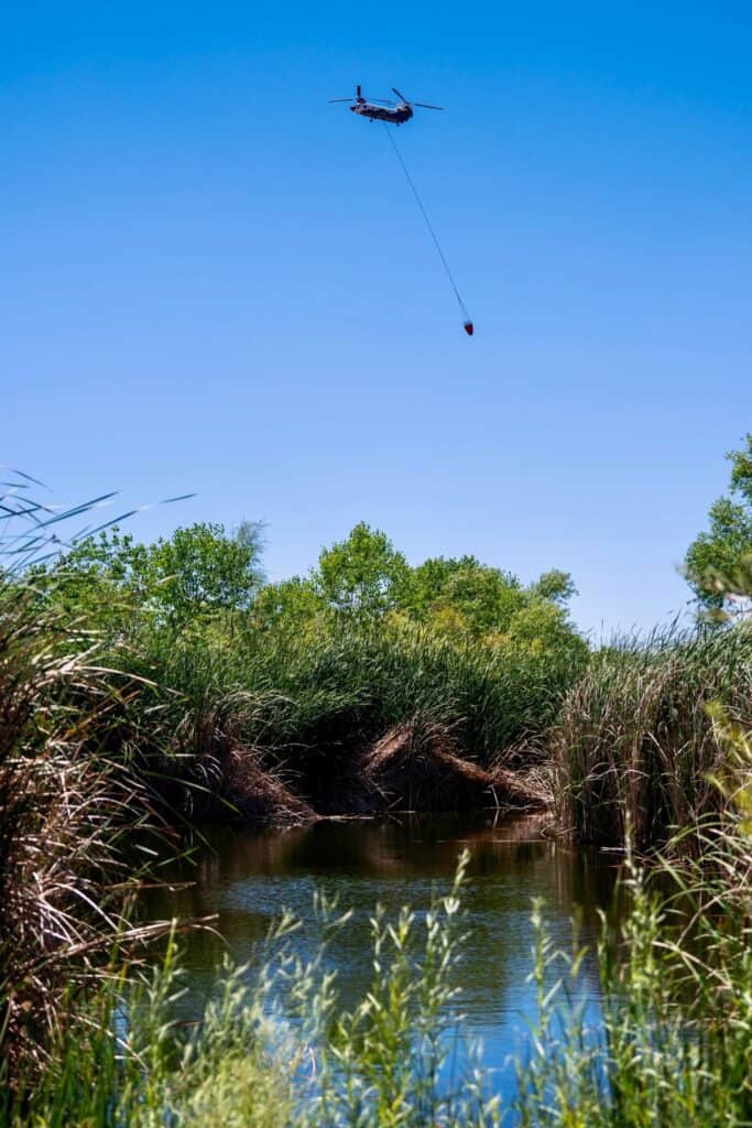
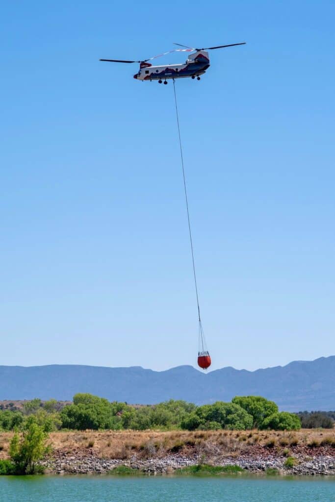
Aerial photos courtesy of pilot Roberto Hoskin
Pilot Roberto Hoskin, flying outside the Temporary Flight Restricton area has been providing the Sedona Red Rock News with photos of the Pocket Fire. He is flying at about 2,000 feet above ground level, or 10,000 feet above sea level.
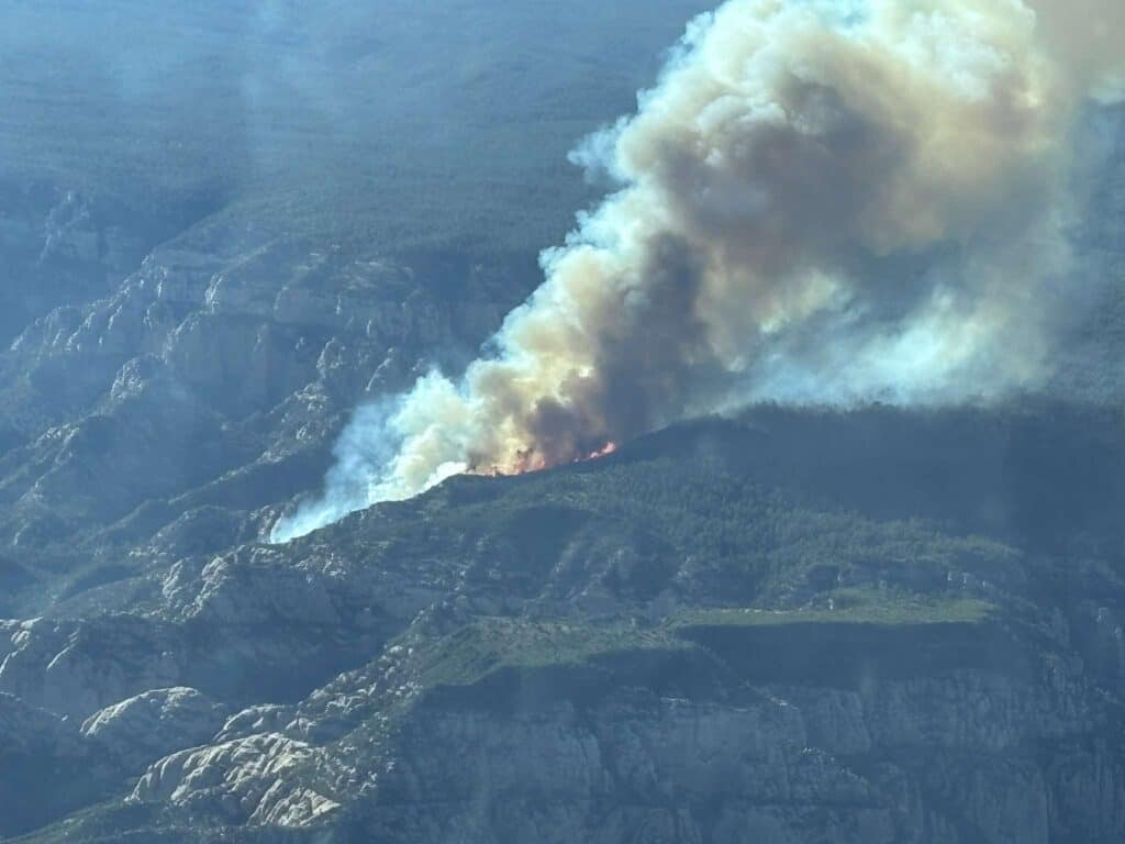
Start of the Pocket Fire
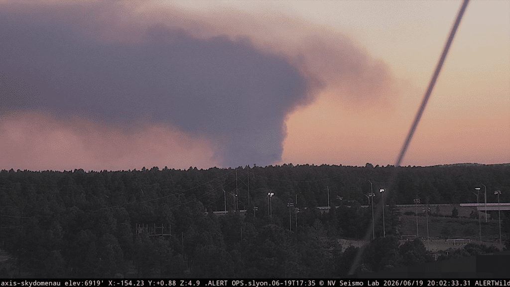
Photos from Edge of the World area Friday, June 19, by Tucson visitor Kayla Janae Brill, all taken within about 15 minutes as the Pocket Fire began around 5 p.m., 3 miles east of Edge of the World and seven miles north of Sedona.
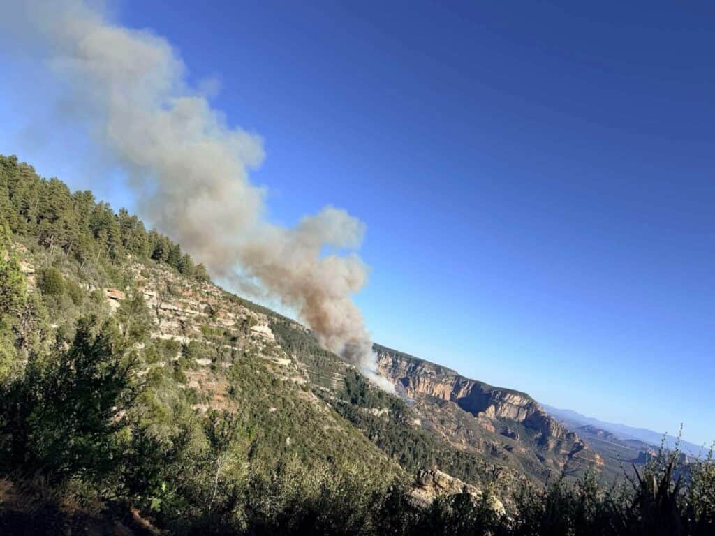
Photo courtesy of Kayla Janae Brill

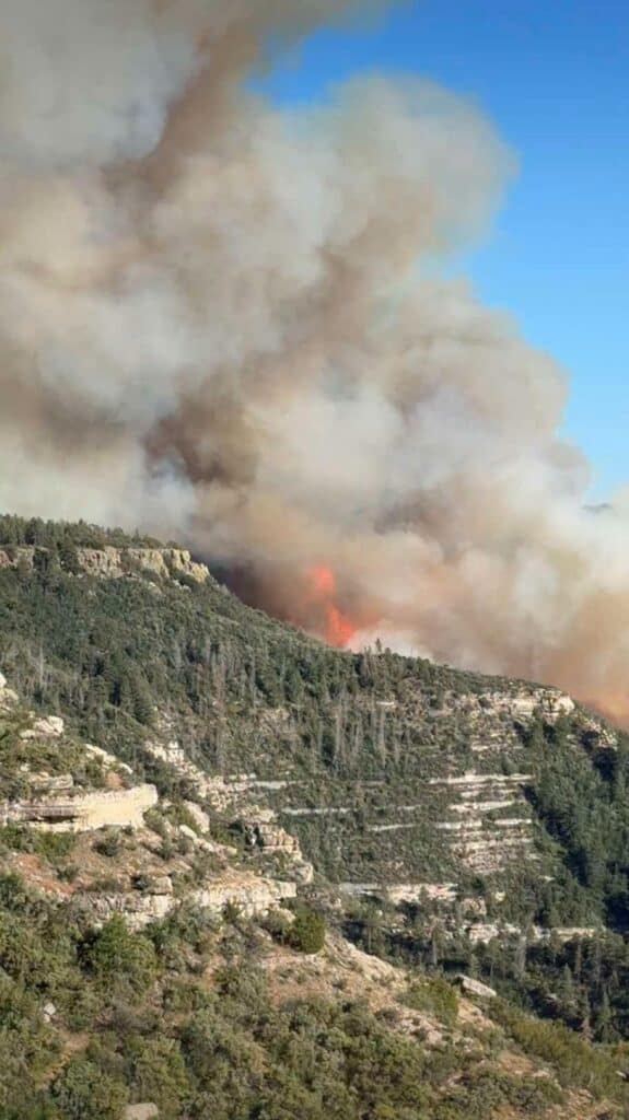
Photo courtesy of Kayla Janae Brill

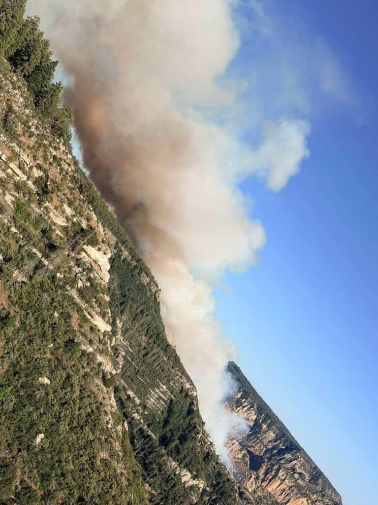
Photo courtesy of Kayla Janae Brill
Flight Restrictions
A Temporary Flight Restriction is in effect surrounding the fire area, per the Federal Aviation Administration. This is to ensure safety of firefighting aircraft. For more information on this TFR, visit: tfr.faa.gov.

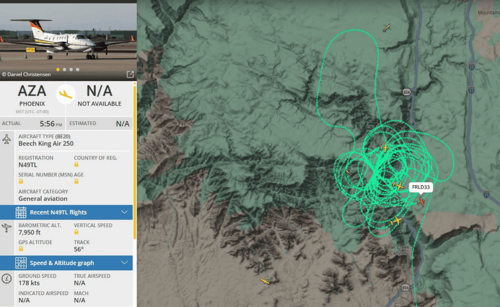
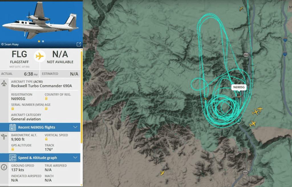
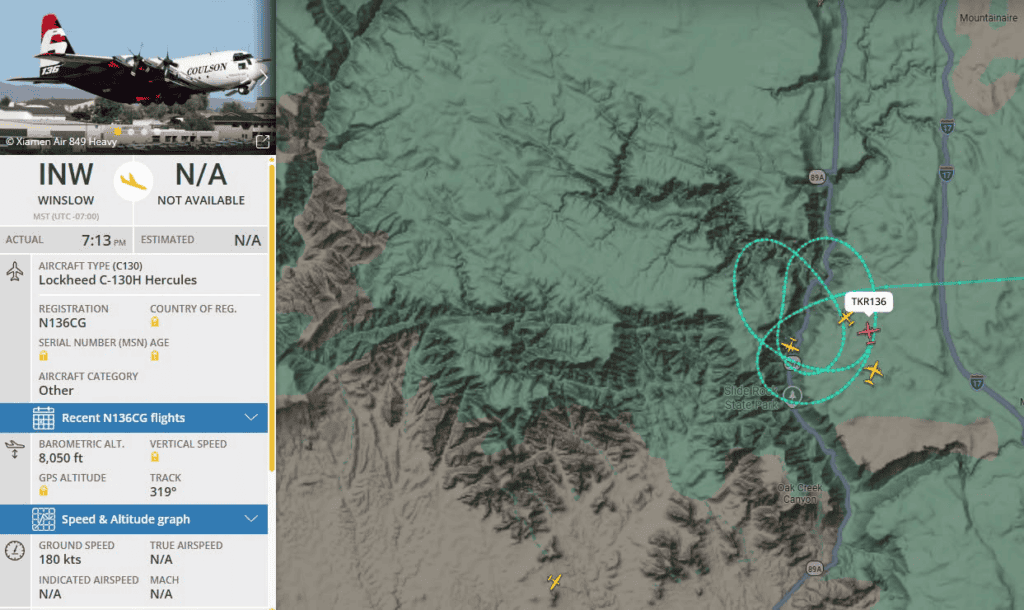
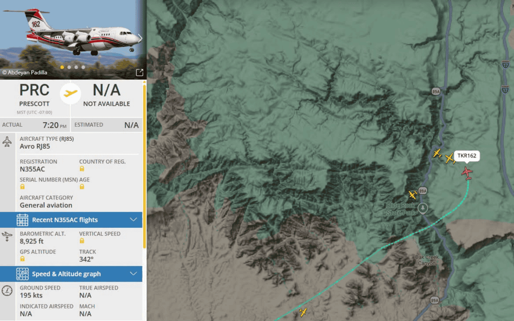
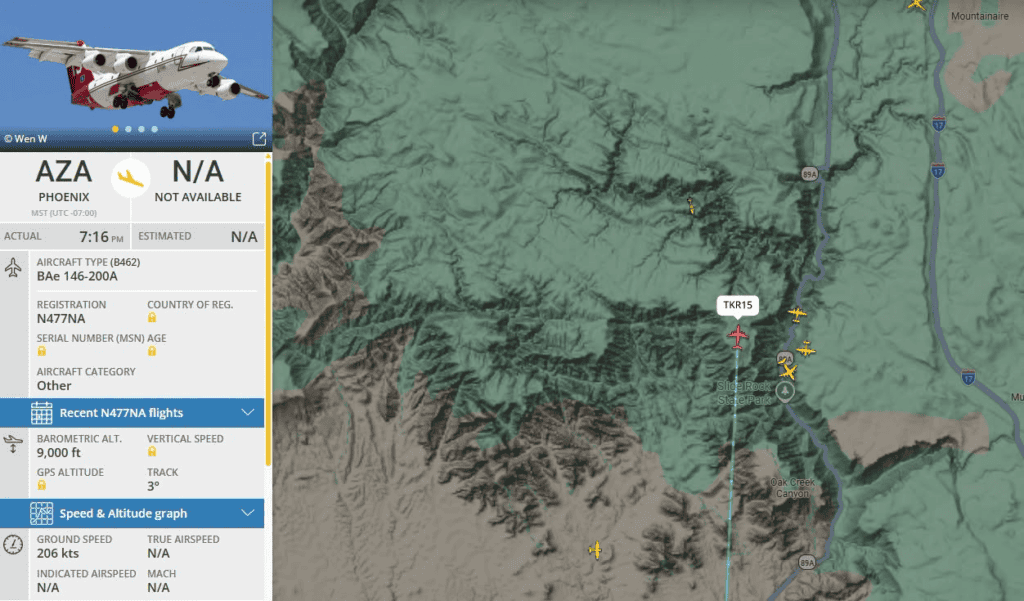
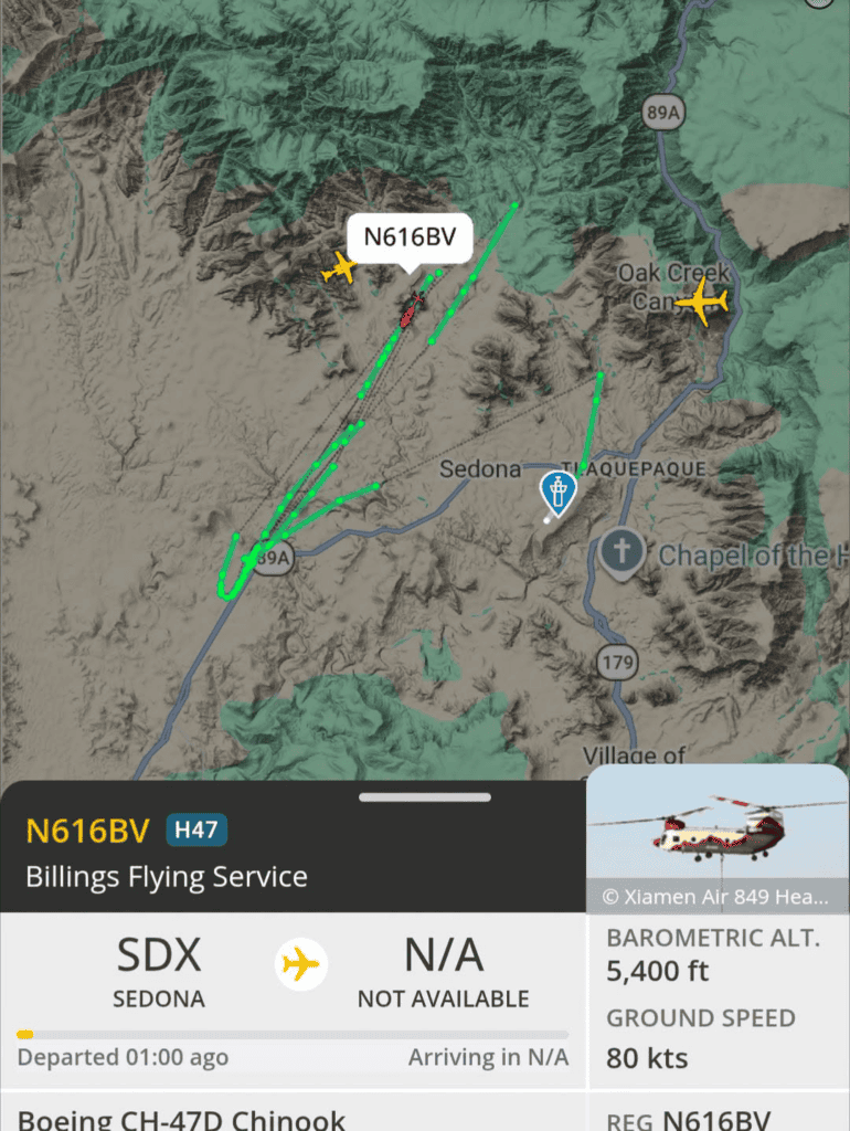
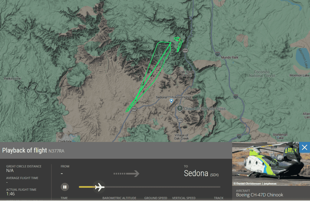
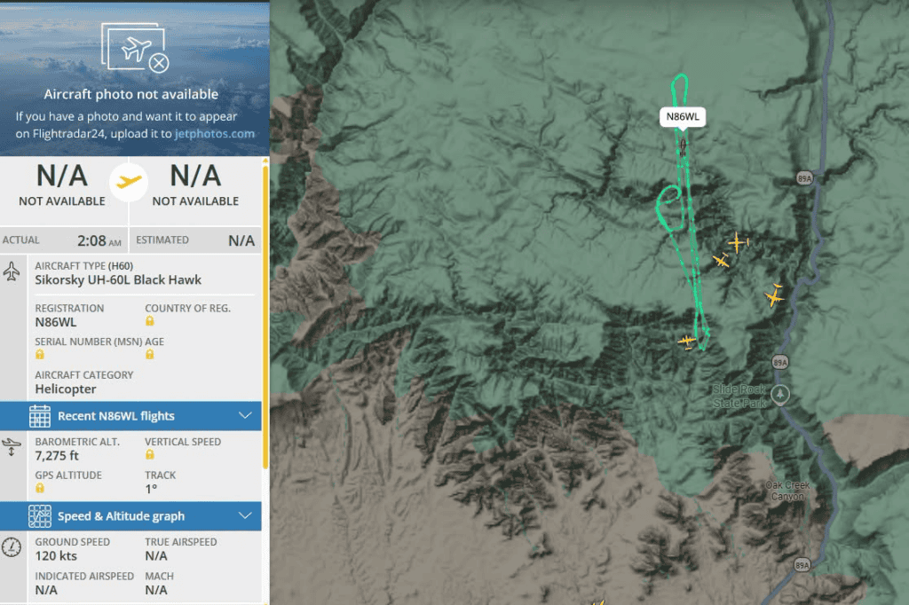
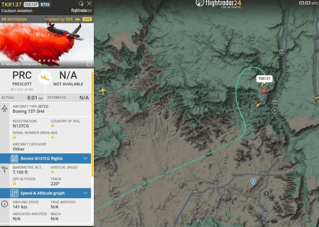
Involved Aircraft:


Trail Closures
In addition to all campgrounds and day use sites located within Oak Creek Canyon, the following trails and trailheads are closed:
- Aerie Trail crossing over Dry Creek Road
- Andante Trailhead
- Bear Mountain Trailhead
- Casner Trailhead
- Dry Creek Road Intersections:
- Dry Creek Road and Boynton Canyon Road (close access to Boynton Canyon Road)
- Dry Creek Road and Long Canyon Road (close access to Long Canyon Road)
- Dry Creek Road and Vultee Road (close access to Vultee Road)
- Fay Canyon Trailhead
- Girdner Trail crossing over Dry Creek Road
- Jim Thompson Trailhead
- Loy Canyon Trailhead
- Ok Trail crossing over Dry Creek Road
- Secret Canyon Trailhead
- Soldier Pass Trailhead
- Sugarloaf Trailhead
- Thunder Mountain Trailhead
Forest Order Closing Area Affected by Pocket Fire
U.S. Department of Agriculture, U.S. Forest Service, Coconino National Forest, Pocket Fire Temporary Area, Road and Trail Closure
PROHIBITIONS
Pursuant to 16 U.S.C. § 551 and 36 C.F.R. § 261.50 (a) and (b), the following are prohibited on the National Forest System (NFS) lands, roads and trails in the Coconino National Forest, described below and shown on the attached map incorporated into this Order as Exhibit A (the “Described Area, Roads and Trails”):
- Entering or being in an area. 36 CFR § 261.52(e)
- Being on the Road 36 CFR § 261.54(e)
- Being on a Trail. 36 CFR § 261.5(a)
EXEMPTIONS
Pursuant to 36 C.F.R. § 261.50(e), the following persons are exempt from this Order:
- Persons with Forest Service Permit No. FS-7700-48 (Permit for Use of Roads, Trails, or Areas Restricted by Regulation or Order), specifically exempting them from this Order or a written determination by a Forest Service authorized officer that a permit is not required under 36 C.F.R. § 251.50(e)(1) or (2).
- Any Federal, State, or Local Officer, or member of an organized rescue or firefighting resource in the performance of an official duty.
DESCRIBED AREA, ROADS and TRAILS
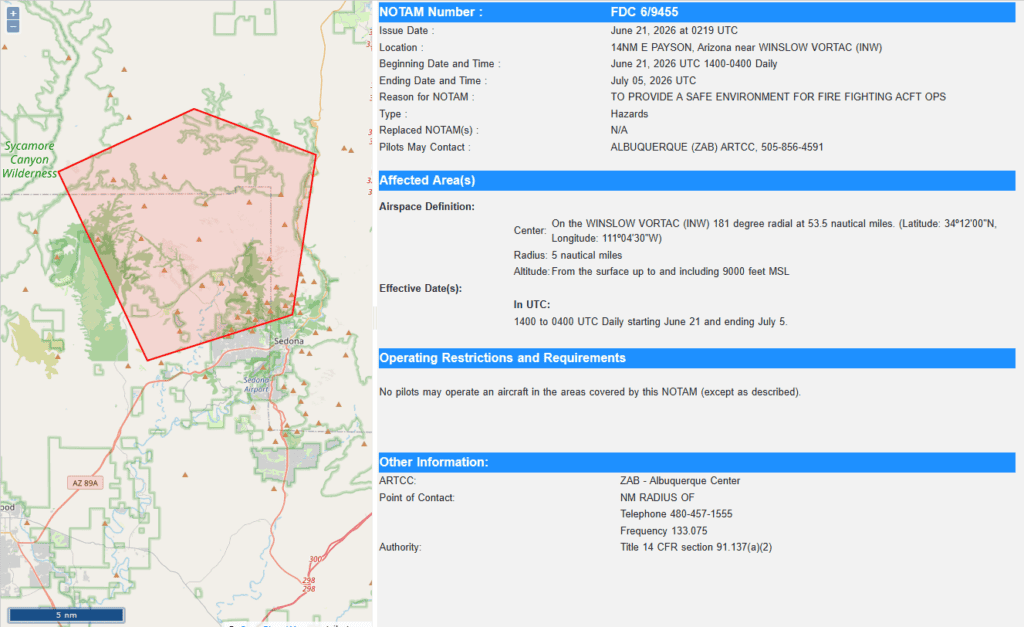
The Described Area consists of all National Forest System Lands, Roads, and Trails within the boundary beginning at the junction of Interstate 40 and Interstate 17. West along Interstate 40 to the administrative Forest boundary and the Camp Navajo administrative boundary. South along the Camp Navajo administrative boundary along the administrative Forest boundary, then west along the Camp Navajo administrative boundary and the administrative Forest boundary to the Kaibab National Forest Administrative boundary and the Coconino National Forest Administrative boundary. South along the Kaibab National Forest Administrative boundary and the Coconino National Forest Administrative boundary to Buck Ridge (Flagstaff Ranger District/Red Rock Ranger District boundary). East along Buck Ridge to the Sycamore Canyon Wilderness Boundary. South along the Sycamore Canyon Wilderness boundary to the junction of Forest Road 538B and Casner Mountain Trailhead. South from the Casner Mountain Trailhead at Forest Road 538B along the Casner Mountain Trail to the junction of Casner Mountain Trail and Forest Road 525C. From the junction of Casner Mountain Trail and Forest Road 525C, West along the Red Rocks Wilderness Boundary to the junction of Forest Road 152C (Boynton Canyon Road or Boynton Pass Road) at the Boynton Canyon Trailhead. From the Boynton Canyon Trailhead South-East along Boynton Canyon/Pass Road (Forest Road 152C to the administrative Forest boundary at the junction of Boynton Canyon/Pass Road and Dry Creek Road (Forest Road 152). From the junction of Boynton Canyon/Pass Road and Dry Creek Road, East along the administrative Forest boundary to Highway 89A at Oak Creek. North along Highway 89A in Oak Creek to the junction of Oak Creek and Casner Canyon Trail. East from the junction of Oak Creek and Casner Canyon Trail along Casner Canyon Trail to the junction of Casner Canyon Trail and Forest Road 09457R. South along Forest Road 09457R to the junction of Forest Road 09457R to Forest Road 153 (Schnebly Hill Road). East along Schnebly Hill Road from the junction of Forest Road 09457R to the junction of Schnebly Hill road and Interstate 17. From the junction of Schnebly Hill Road and Interstate 17 North along Interstate 17 to the beginning at Interstate 17 and Interstate 40.


