


Turkey Creek
The majority of the proposed improvements would be to the Turkey Creek trail system, which is located about one mile west of the Verde Valley School throughout a roughly 1,800-acre area that includes the entirety of Red Rock State Park. The Forest Service has proposed expanding this network by building 20 miles of new trails and recognizing the existence of 10.9 miles of user-created routes, known as social trails.
“It’s a beautiful area that is used by hikers, bikers and equestrians, [but] it is overused in some areas where they have developed miles of social trails,” Sedona Red Rock Trail Fund Vice President Sandi Heysinger said. “We’ve had a large project ongoing to survey that entire area, see where the social trails are and then look and see where the trails should be. In some cases, it will be taking social trails that are existing and incorporating that into the trail system, but putting them in a place that is better environmentally.”
“With recreational use in the Turkey Creek basin increasing, 20.68 miles of user-created routes have been inventoried,” the Forest Service’s scoping letter for the proposal stated.
“These social routes are ad hoc and unmaintained, damaging soils and vegetation and poorly meeting the needs of trail users. The project would reroute portions of the Turkey Creek Trail and would link Forest Service trails to the Red Rock State Park and nearby trails to enhance overall trail capacity.”
Infrastructure would also be improved, with the Turkey Creek Trailhead parking lot being enlarged from five to 30 allowable vehicles as well as to accommodate signage and a toilet.
“Trail improvements would begin during spring 2024,” the Forest Service scoping letter stated. “The Turkey Creek trail system would … use Forest Service trail crews and volunteers. In addition, assistance from conservation youth corps crews over a three-year implementation timeline would occur with funding from the Sedona Red Rock Trail Fund.”
Other proposed locations considered for trail work include Cornville, the Bell Rock area bypasses, Cornville School Trail, Doe Mesa Loop, the Hardline Trail and the Scheurman Trail Connector.
Cornville
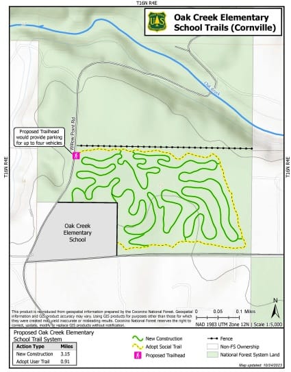
Cornville would have 3.15 miles of new trail constructed adjacent to the Oak Creek Elementary School, which would be referred to as the Cornville Community Trail.
The project would also include the recognition of a 0.91-mile existing unofficial trail and the construction of a small parking area just north of the school on Willow Point Road that could accommodate four vehicles.
“Since the 1990s, the community has sought nonmotorized trail opportunities on National Forest land that would link to Windmill Park and other outdoor area venues,” the scoping letter stated. “The now-defunct Cornville Trail Coalition worked with the Forest Service for more than a decade to identify potential trail locations, complicated by proximity to sensitive Oak Creek areas and land exchange proposals.”
Scheurman Trail Connector
The Forest Service is proposing a 500-foot trail that would connect Upper Red Rock Loop Road to the Scheurman Mountain Trail. Currently, the only way to access that trailhead is through the parking lot of Sedona Red Rock High School.
“This access to the Scheurman Mountain Trailhead through the school parking lot is allowed outside of school operating hours,” the scoping letter stated. “However, it is not allowed during school hours. Need for access to the trailhead is causing conflict for both school administration and Forest Service visitors.”
“A separate trailhead would benefit the school because it would cut down on foot traffic, both after school hours and during the day,” Sedona-Oak Creek School District Superintendent Tom Swaninger said in support of the project. “By creating a separate trailhead that would alleviate any confusion and increase the safety of our campus.”
Bell Rock
The Forest Service has proposed two bypass routes for the Bell Rock Vista Trailhead, the construction of a 0.64-mile bicycle bypass and the recognition of an existing 0.11-mile trail from Courthouse Butte to Bell Rock as an equestrian bypass, to separate those activities from foot traffic. This realignment would also result in a quarter of a mile of trail being decommissioned.
Cathedral Rock
The Forest Service is proposing to recognize the existence of a 0.92-mile trail that connects the Hiline Trail near the Yavapai Vista parking lot to the Templeton Trail and Cathedral Rock. This part of the proposal would not involve any new trail construction.
Doe Mesa Loop
The Doe Mesa Loop component of the project would involve the Forest Service recognizing the existence of a 1.96-mile trail at the end of the Doe Mountain Trail off Boynton Canyon Road that makes a loop around Doe Mountain from the terminus of Doe Mountain Trail. It would also add a new 0.15-mile trail that would bisect the loop.
“This proposed loop would offer a maintained trail around the Doe Mountain top and would improve user experience as well as reduces soil and vegetation impacts,” the scoping letter stated. “As part of this proposal, the excess user-created trails not adopted as part of the loop would be restored to a natural condition.”
Comments
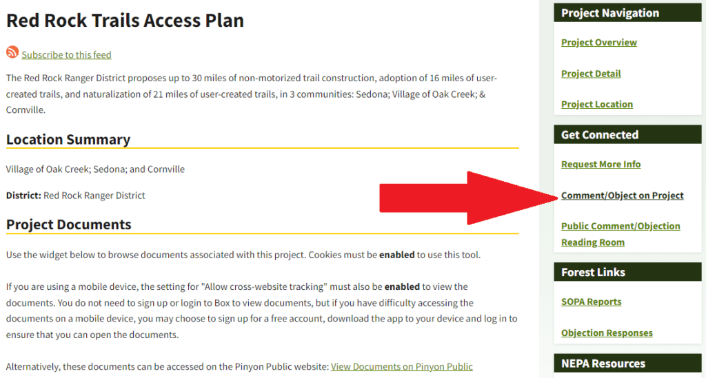
The Forest Service proposal is available under “Red Rock Trails Access Plan” on fs.usda.gov. Comments can be made online under the link: “Comment/Object on Project” on the right of the page. The public comment period will close on Tuesday, Dec. 19.
Comments can also be mailed to: Red Rock Ranger District, Attention: Red Rock Trails Enhancement, P.O. Box 20429, Sedona, AZ 86341. The Forest Service will hold a public meeting on the proposals on Tuesday, Dec. 5, from 4 to 6 p.m. at the Red Rock Ranger Station at 8375 State Route 179. Written comments may also be dropped off at the ranger station. A decision memo on these proposals is currently expected in January.


