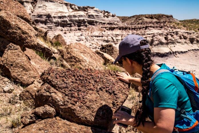
Satellite imagery has the potential to assist paleontologists in focusing their efforts where to look for new fossil discoveries and help land managers monitor paleontological resources according to new research conducted at Petrified Forest National Park by the University of Oregon published in the journal Geological Magazine in November.
“The potential applications of finding fossil-rich areas using chemical differences visible from space are limitless,” said PEFO paleontologist Adam Marsh in a recent email. ”It could help us identify particularly sensitive areas to protect in the park and also those that might be more scientifically significant for our research.”
This is the first time researchers have attempted to locate individual fossils on the landscape while previous works focused on looking for outcrops for fossil excavation. The project’s goal is to be able to get huge areas mapped using satellites, so people don’t have to physically set foot in those areas to reduce workloads and increase worker safety according to UO paleontologist Edward Davis.
UO examined multispectrum satellite imagery, which includes visible light, ultraviolet and infrared radiation. Researchers were then able to distinguish individual fossil logs on the Crystal Forest Trail from the backdrop by observing how light is reflected or absorbed on the landscape.
“We didn’t feel like this was a method that would find the fossils for you,” Davis said, who noted the work has a long way to go. “It was better for telling you where not to look. If it told you not to look in a place (based on the satellite imagery) you could be pretty confident you weren’t missing anything there.”
There’s interest by land managers to use satellite imagery but Davis doesn’t think it’s developed enough for agencies to pursue it as an option because of technical and political hurdles.
A fossil must be larger than a single pixel in the image and its mineral composition must be different from the bedrock it’s located in order to stand out in satellite data. However the biggest limitation is image resolution that academic researchers have access to according to Davis.
“That’s part of why we used PEFO because the petrified logs are large enough that you can see them well from space,” Davis said. “My understanding is that the government has satellites with much higher resolution that would work for finding smaller fossils, but those are reserved for covert operations.”
Davis thinks as the technology improves researchers will get access to higher resolution images, especially for monitoring purposes or developing fieldwork plans for secluded areas.
Drones
Until then, drone footage is a viable option to look for the chemical differences between fossil and rock however it still requires people on the ground to operate equipment and regulations are in place limiting the use of drones in National Park Service units.
“Elena Ghezzo who led this paper has a project to scan (for) fossils in the John Day Fossil Beds National Monument here in Oregon and in the Bureau of Land Management land nearby,” Davis said. “That data is still under analysis but it looks promising. She also has another project with fossil whales in South America where the whale fossils are big enough on the surface like the petrified trees that you can see them with satellite imagery.”
Drone footage comes with its own challenges for researchers because they need to account for the direction the rock faces schedule shooting times to maximum sun exposure so they’re getting sharp bright returns off the rock.
“One of the other limitations is drone usage is limited inside the national monument,” Davis said. “We got good drone imagery from the BLM lands nearby but when Ghezzo was in the monument I believe she had to use a tall pole with the camera on top of it because there’s concerns about having the drones disturb the environment and the human visitors. The NPS has very strict rules about drone use and I think it’s appropriate but it does limit some of the work.”
Using imagery to spot fossils is much “easier when the landscape is flat and open, with relatively few obstructions,” like at PEFO according to the UO press release. “But other data about the geology and topography of the region can also be factored in to help researchers distinguish a fossil from, a tree or a big rock.”
This method also works best when the mineral makeup of the fossil differs from its parent rock, which is dependent on biology and the content’s of the groundwater during the fossilization process.
“The fossil bones of vertebrates often will retain some or all of the original minerals that the animal produced when it was alive,” Davis said. “When you’re looking at a dinosaur fossil the bone itself is often still there. We can look at the actual minerals that the animal produced millions of years ago when it was alive.”
Bone is made up of hydroxyapatite which is a mineral and a lot of collagen fibers, the same material that makes skin flexible, Davis pointed out. When an animal dies collagen will decompose leaving behind voids where the collagen used to be.
Over geologic time as groundwater moves through it will hit the fossils and slow down. As it slows down, it’ll release the minerals which are dissolved in the groundwater. It’s a process very similar to the way that water drips in a cave and produces stalactites.
This void filling process is refered to as “perminerlziation” and a bit of a different process “petrification” occurred to the logs at PEFO to make it an ideal study area. Where without those collagen voids to accumulate the minerals carried by groundwater replaced the planet material over millions of years “almost atom by atom” Davis said.
“With a lot of petrified logs you can cut them into thin sections and put under a microscope and still see the shapes of the original cells,” he said. “But none of that material is there anymore. It’s all been replaced by new minerals so you end up with PEFO where the logs have a very different mineral composition and a very different characteristic color than the surrounding rock does.”
UO’s method does apply to both processes and is adatable to the remains of exposed fossils from tree to dinosaur.
“In the end,” Davis said. “You could sit down with satellite images and say ‘This looks like there might be fossils there.’ But it would cost a lot of hours. What we’re trying to do is automate the process with eventually machine learning so that a computer could do this much faster, and less expense. The PEFO example is just a case study because people know where the logs are. But the idea is that you would train the computer with a known area and then give it thousands of images of a nearby countryside (to) quickly come up with high probability places that you should explore.”


