


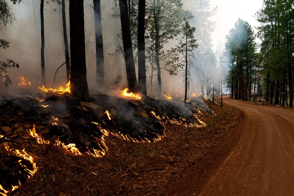
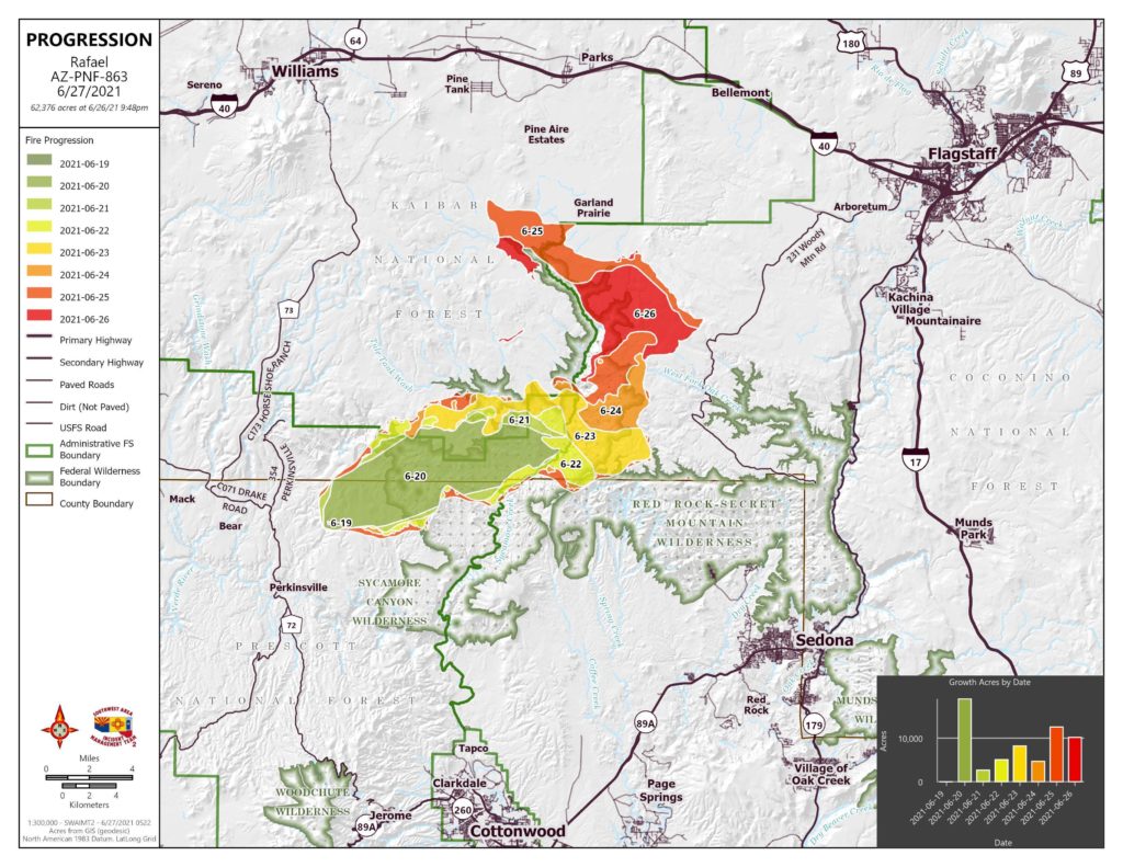
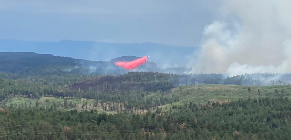
The Rafael Fire grew from 45,899 acres Saturday, June 26, to 62,376 acres Sunday, June 27, due to backburn operations conducted by wildland firefighters to establish a northern and eastern perimeter to prevent to fire from growing once it reaches the burn out lines.
Acres: 62,376
Percent Containment: 11%
Detected: Friday, June 18, at 7:27 p.m.
Structures Damaged/Destroyed: 0
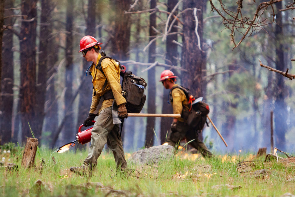
Number of Personnel: 664
Cause: Lightning
Origin: 4 miles north of Perkinsville
Yesterday, Saturday, June 26, crews finished the burnout operation, completing containment line from Turkey Butte lookout to the Boy Scout camp on the northeast edge of the fire.
Today, Sunday, June 27, this line will be patrolled and mopped up. This operation was designed to prevent movement of the fire to the northeast toward Flagstaff, and other values at risk. Firefighters will continue a firing operation from White Horse Lake Recreation Site to JD Dam and west to Pine Flat, using forest roads as a fire break.
Near the fire origin, crews will check the fire’s edge for hot spots and mop them up north to Government Canyon. On the south side of the fire, firefighters will continue hand line in Mooney Canyon, and structure protection specialists will continue to assess values at risk from Loy Canyon to Seven Canyons Resort.
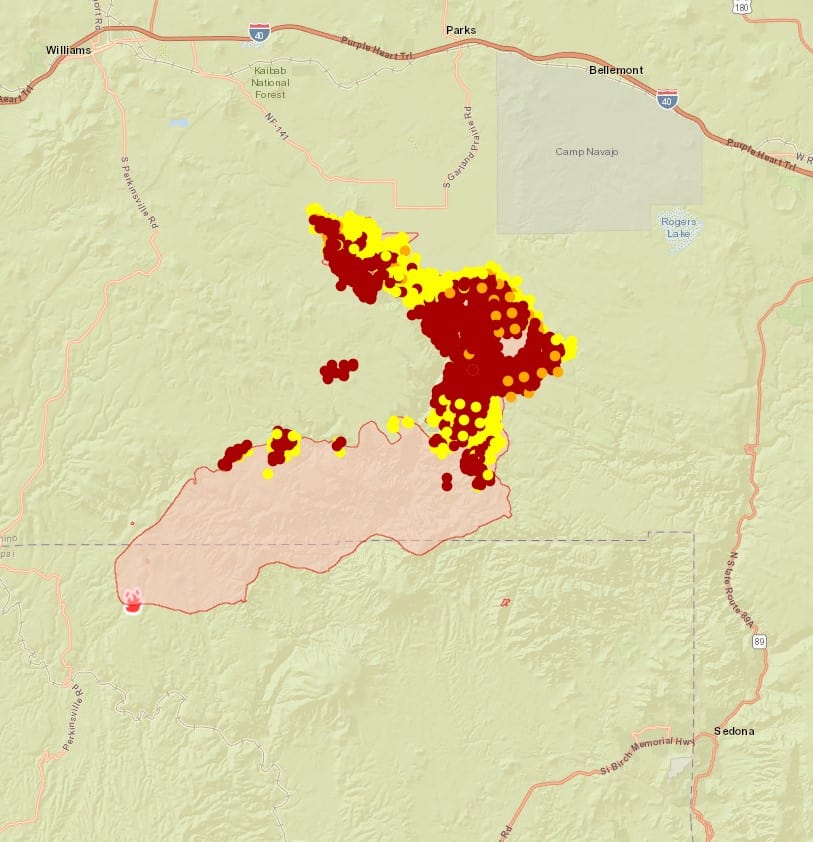
Approximately 10 miles of burning is left to contain the north end of the fire and crews will attempt to complete that operation today if weather conditions allow.
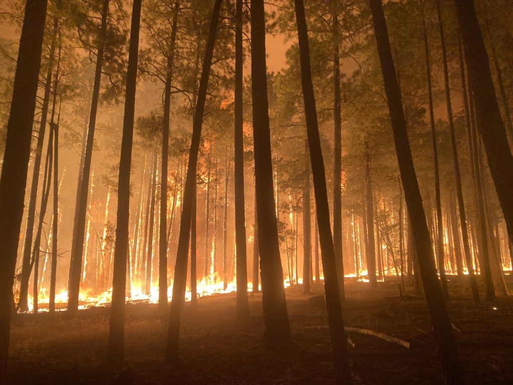
Consequently, smoke is expected to be more noticeable, and may settle in low lying areas, such as Verde Valley and Prescott Valley, lifting by late morning. Smoke columns will be visible throughout the day as burning operations continue.
Smoke forecasts are available at Wildfire Smoke Forecast | ADEQ ArizonaDepartment of Environmental Quality(azdeq.gov) and https://fires.airfire.org/outlooks/NorthCentralArizona. Today a Burned Area Emergency Response team will begin assessing fire impacts to soils and watersheds.
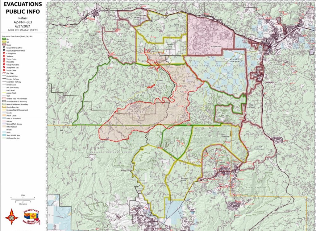
Evacuation status as of 6 a.m. June 27 (Notifications are in place until status is rescinded or changed by each respective sheriff’s office:
“GO” in Coconino County Sycamore Canyon and in Yavapai County, Loy Ranch. American Red Cross (ARC) activated a shelter to support those who have been evacuated due to the fire. ARC Shelter is located at Sinagua Middle School, 3950 E. Butler Ave., Flagstaff, AZ 86004.
“SET” – in Coconino County, Garland Prairie South and Garland Prairie North. In Yavapai County, Grey Ranch, Windmill Ranch and BearMountain.
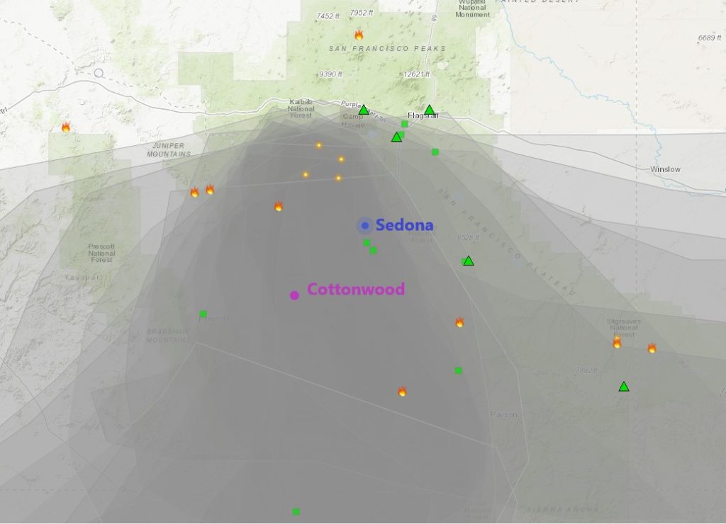
“READY” -– in Coconino County, South of Williams, Sherwood Forest, Camp Navajo, West of I-17 south of 1-40, Westwood Estates, Flagstaff Ranch (including W.L. Gore), Mountain Dell, Pine Del, Forest Highlands, Kachina Village, University Heights, Equestrian Estates, Upper Oak Creek canyon, West Fork, Lower Oak Creek canyon and in Yavapai County, Sedona.
It’s fire season in Northern Arizona. All residents in Northern Arizona should be in Ready status.
Information about evacuation status can be found on the Coconino County Facebook page at: https://www.facebook.com/CoconinoCounty and at the Yavapai County Sheriff’s Department Facebook page at: https://www.facebook.com/YavapaiCountySheriff/
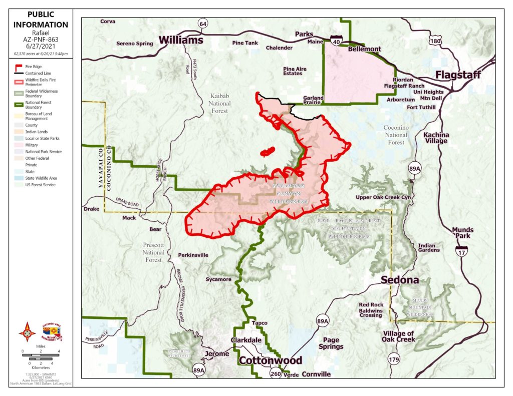
The Rafael Fire was discovered on June 18, 2021, on the Prescott National Forest, the result of passing predominantly dry thunderstorms. The fire was discovered in a remote area approximately 4 miles north of Perkinsville had grown to 1,000 acres by the morning of June 20, 2021. At this time, the Arizona Central West Zone Type 3 Incident Management Team assumed management of the Rafael Fire. Strong winds on June 20, 2021, combined with dry fuels and favorable uphill topography in front of the fire, added nearly 18,000 acres.
On June 21st, the fire added another approximately 5,500 acres and continued to burn actively within the Sycamore Canyon Wilderness on the Kaibab National Forest. On June 22, 2021, the fire continued to move east and crossed into the Coconino National Forest. Again, topography and dry fuels drove the fire and by the morning of June 23rd the fire had grown to 34, 949 acres. On the morning of June 24, the Southwest Area Type 1 Incident Management Team 2 led by Incident Commander Dave Bales assumed management of the fire. The Rafael Fire now involves the Prescott, Kaibab, and Coconino National Forests and spans the Yavapai/Coconino County line.
Planned Actions:
In the northeast portion of the fire, hold burnout operations and improve line as needed. In the northern portion of the fire, extend burnout operations to the west along the 12 and 105 roads and look for opportunities to tie into Sycamore Point. Southeast portion of the fire: Continue to go as direct as possible while using air resources to monitor fire activity and limit fire spread to the SE to protect Sedona. Improve contingency control lines and scout for opportunities for additional line construction.
Projected Incident Activity
Next 12 hours operational period:
(Saturday night) Decreasing cloudiness with cooler temperatures bringing better humidity recovery. Down valley wind staying breezy overnight. Predicted northerly winds as well as downslope/down canyon terrain driven winds will allow previous burnout operations conducted on the northern perimeter to continue backing slowly down into the headwaters of Sycamore Canyon. Operations – Northern portion of the fire: To contain the forward progression of the fire and protect Flagstaff, Camp Navajo, I-40, I-17, powerlines and other values at risk, hold previous burnout operations from Sycamore Falls, east to FR538. Continue burnout operations from Sycamore Falls, south to White Horse Ranger Station and from the Forest Road 527/538 junction, SW to the fire perimeter near Turkey Butte. Continue to prep the 105 road for future planned burnout operations. Southeast portion of the fire: Ground resources will go direct as much as possible, starting near Bunker Hill and will continue SW. Continue to use air resources to limit fire spread to the SE as needed to protect Sedona and adjacent values at risk. Improve installed dozer and hand lines and scout for opportunities for additional line location between natural barriers. Western portion: Continue to monitor the heel of the fire with ground resources and aircraft for possible fire activity. Around the fire perimeter, continue to assess values at risk and control features with high probability of success.
Next 24 hours operational period:
(Sunday) Clearer skies leading to much warmer temperatures, with 90’s in the valley bottoms and lower to mid 80’s at the top of the Mogollon Rim. Humidity 11 to 21 percent. However, wind will be lighter in the afternoon than during the previous night. Predicted northeasterly winds in the early part of the burn period will allow fire along the northern perimeter to push further down into the headwaters of Little Spring Canyon and allow fire above the canyon rim to grow towards Railroad Draw. Fire established in the headwaters of Sycamore Canyon has the potential to experience a slope reversal to the west and make an aggressive push upslope towards White Horse Ranger Station. Northeasterly winds should help minimize growth and activity throughout the eastern fire perimeter. Operations – Northern portion of the fire: Hold and improve line in the northeast portions of the fire and deepen prior burnouts as needed. Extend burnout operations to the west along the 12 and 105 roads. Look for opportunities to bring fire south to Sycamore Point and tying into the fire perimeter. Southeast portion of the fire: Continue to go as direct as possible while using air resources to monitor fire activity and limit fire spread to the SE to protect Sedona. Improve contingency control lines and scout for opportunities for additional line construction. Western portion: Monitor for fire activity.
Next 48 hours operational period:
(Sunday night and Monday) Slight chance of dry thunderstorms returns Monday afternoon. Cooler temperatures with humidity increasing to above 15 percent. East wind expected to gust on the ridges to near 25 mph, mainly during the morning, then decreasing slightly for the afternoon. Winds are expected to shift between easterly and southeasterly which will continue to push fire west past Railroad Draw and throughout Little Spring Canyon. Fire established within the upper reaches of Sycamore Canyon will continue pushing west up the canyon walls towards the FS109 road. Southeasterly winds will aid in allowing remaining persistent smoldering fuels in the upper portions of Mooney Canyon to burn out while reducing potential for backing fire. Operations – Similar to above with possible increased suppression in the SE portion depending on fire activity and continued extension of burnout operations across the northern portion along the 12 and 105 roads.
Next 72 hours operational period:
(Monday night and Tuesday) Partly cloudy with a chance of thunderstorms Tuesday afternoon. Afternoon temperatures 4 to 8 degrees, humidity up strongly. East wind gusting up to 30 mph during the afternoon, even outside of thunderstorms. Predicted higher humidity may be offset by strong gusty winds out of the southeast. Majority of expected fire activity will continue to be concentrated between Tule Canyon and the upper portion of Sycamore Canyon as well as fire backing downcanyon in Little Spring Canyon. Operations – Similar to above with continued burnout operations and holding/improving line. Possible increased suppression in the SE portion depending on fire activity.
Anticipated after 72 hours:
Wednesday has a chance of thunderstorms all day with the greatest chance of thunderstorms on Thursday, July 1. Thunderstorm threat continues into the 04 July weekend. Primary growth is expected to be within the northern reaches of Sycamore Canyon. Operations – Continue with burnout operations as appropriate. Hold and improve line on the north, east and southeast portions of the fire. Monitor the heel of the fire on the west side.


