

The rain has arrived after weeks of smoke and flames.
The Pocket Fire reached 95% containment at 27,393 acres as of Sunday, July 19. Summer precipitation has kept the fire, which ignited June 19, in check over the last week and prompted the Coconino National Forest to lift fire restrictions Monday, July 20, “due to recent widespread precipitation across the forest.”
As the fire settled, the large-scale response scaled back. Command of the Pocket Fire returned to the Coconino National Forest, transferred from Southwest Area Incident Management Team 2, California Interagency Incident Management Team 6 and the Northern Arizona Type 3 Incident Management Team which had rotated management.
“Fire danger indices continue to decline as monsoonal moisture increases, with values expected to fall below seasonal averages and reduce the potential for significant fire activity,” the Coconino National Forest wrote in its final update on July 18. “Although the [Keetch-Byram Drought Index] remains historically high, improving weather conditions have moderated overall fire danger. Fuels remain dry and receptive to ignition, but the risk of sustained fire growth continues to decrease.”
But the same rain that tamped the fire brings its own hazard, and the steep terrain that made fighting the Pocket Fire so difficult increases the risk of flooding.
“The people of Arizona are always concerned with flooding in the monsoonal events, but in post-fire settings it’s also the material that gets put into the water,” said Andrew Sánchez Meador, executive director of the Ecological Restoration Institute and a Northern Arizona University professor in the School of Forestry. “There’s ash, there’s sediment, there can be logs and trees. Those logs and trees can dam up a culvert, and then the culvert and road can blow out, and so now you have rocks and debris and asphalt and a culvert in the flow.”
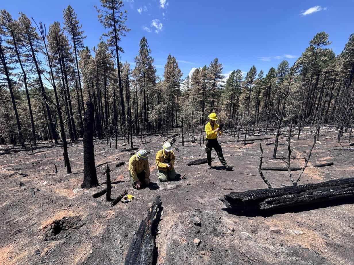
The USFS announced on July 15 that a Burned Area Emergency Response team composed of federal and state scientists and trail specialists started their work assessing the burned area “to determine the level of risk from potential flooding and debris flow to values on National Forest System lands,” the announcement reads.
“On Forest Service lands, we look at how the fire affected the landscape,” USFS spokesman Dick Fleishman said. “Did it create issues that would affect life, property, cultural and natural resources, plus Forest Service infrastructure? We validate the soil burn severity, and that’s our base product, because soil will affect how water moves off the land.”
The work involves weighing risk to campgrounds, roads and trails, along with more than 400 cultural resources such as archaeological sites and habitat for protected species in the burn area, primarily the Mexican spotted owl and the narrow-headed garter snake.
“Oak Creek went from 31 cubic feet per second yesterday to over 600 this morning,” Fleishman said on Friday, July 17. “We had a rain event last night that put quite a bit of ash-laden water through Oak Creek as well as Dry Creek. Dry Creek actually ran and covered the bridge just before … that intersection where the road splits toward Seven Canyons. So we’ve already had some flood events, we have forecasted a pretty juicy monsoon and we can expect to have events multiple times this summer.”
Northbound 89A through Oak Creek Canyon was temporarily closed July 17 because of a rock slide but reopened by 7:30 a.m.
“The good thing about Oak Creek is it’s a very well-defined stream channel. It’s going to take a lot of water for it to get out of its banks,” Fleishman said. “If you get some debris blockage, it could turn that water and go places where it’s not supposed to go, but it’ll get confined by that canyon.”
Because of flooding risk, the USFS closed Oak Creek to the public between West Fork and Uptown, prohibiting creek access, under an order issued July 18 and running through Monday, Aug. 3. The order also closes six picnic areas along the canyon: Call of the Canyon, Bootlegger, Banjo Bill, Halfway, Encinoso and Grasshopper Point.
The newest closure order accompanies an existing order, effective July 13, that closed trails: A.B. Young, Bear Sign, Boynton Canyon, Brins Mesa, Casner Canyon, Casner Mountain, Deadmans Pass, Devil’s Bridge, Dry Creek, Jim Thompson, Kelsey, Long Canyon, Mescal, North Wilson, Secret Mountain, Secret Canyon, Soldier Pass, Soldiers Crossing, Vultee Arch, West Fork, Wilson Canyon, Wilson Mountain and Winter Cabin. The order also closed Call of the Canyon, which appears in both orders.
The BAER announced the completion of its Soil Burn Severity map, that looks at the fire’s effect on the soil and subsoil and not the vegetation for the Pocket Fire on Monday, July 20.
Additionally on July 20, the Arizona Department of Forestry and Fire Management announced that recent rain has lifted fire restrictions on State Trust land across the state.
The final assessment estimates approximately 1,295 acres (5%) of the fire is unburned/very low, about 17,883 acres (65%) is low soil burn severity, roughly 7,419 acres (27%) is moderate SBS, and approximately 876 acres (3%) is high SBS, according to Fleishman, who said the Burned Area Emergency Response team initially released the low and moderate figures inverted.
“Properly functioning soil acts like a sponge,” Fleishman said. “If it burns hot enough, the vegetation creates a waxy surface that plugs all that nice spongy soil and turns it into more like a roof. So you go from a sponge to a roof. That’s called hydrophobicity. This fire, they found quite a few areas with canopies removed but still functioning soil, and that’s mainly because the fire moved through so fast with those strong winds.”
Sedona residents can fill sandbags for free at four locations but must bring their own shovels. Sand is available at the City Maintenance Yard, 2070 Contractors Road; the city lot next to Sedona Red Rock High School, 935 Upper Red Rock Loop Road; the Uptown public parking lot, 260 Schnebly Road; and Sedona United Methodist Church, 110 Indian Cliffs Road.
“People should pay attention to the weather, because when we get rain events on [the burned area], it’s going to run water, that’s for sure,” Fleishman said.
The City Maintenance Yard site is by appointment only for residents with disabilities who cannot fill their own sandbags. Call 928-203-5063.
Editor’s note: The U.S. Forest Service announced after the Wednesday, July 22, issue deadline that the Burned Area Emergency Response team reported to the public and media the incorrect numbers about the soil burn severity, inverting “low” and “moderate” severity, that the NEWS had published in this story. The updated numbers are 17,883 acres of the Pocket Fire are low burn severity and 7,419 acres have moderate soil burn severity, according to USFS spokesman Dick Fleishman. This version has been updated with the corrected figures.


