


Wildfires are constantly evolving natural disasters. Due to geography, fires do not affect residents and workers of a community in the same way. Here are list of government websites we use to inform our reporting and which you can use to keep yourself safe.
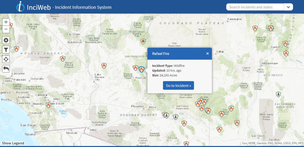
Incident Information System or “InciWeb” is an interagency all-risk incident information management system. The system was developed with two primary missions: Provide the public a single source of incident related information and provide a standardized reporting tool for the Public Affairs community
It compiles information from 10 Area Coordination Centers including the Southwest Area Coordination Center that includes Arizona.
https://inciweb.nwcg.gov/
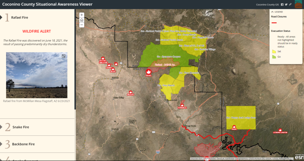
Coconino County Situational Awareness Viewer. Relying on the Coconino County GIS and the ArcGIS nationwide GIS system, this informs residents about the “Ready, Set, Go” evacuation system. It covers more than just Coconino County.
https://bit.ly/3gX4nJS .
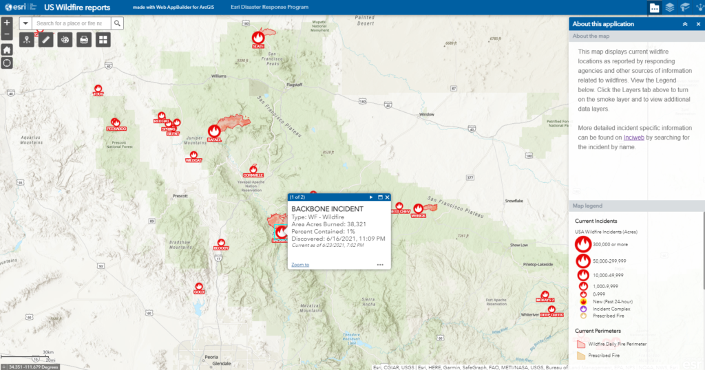
US Wildfire reports, made with Web AppBuilder for ArcGIS, is an Esri Disaster Response Program.
https://bit.ly/3xN6FSp
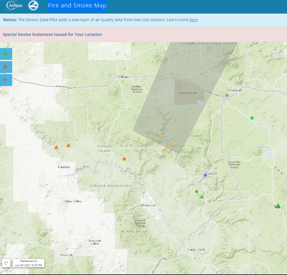
AirNow’s Fire and Smoke Map reports air quality using the official U.S. Air Quality Index, a color-coded index designed to communicate whether air quality is healthy or unhealthy. AirNow is a partnership of the U.S. Environmental Protection Agency, National Oceanic and Atmospheric Administration, National Park Service, NASA, Centers for Disease Control, and tribal, state, and local air quality agencies.
https://fire.airnow.gov/
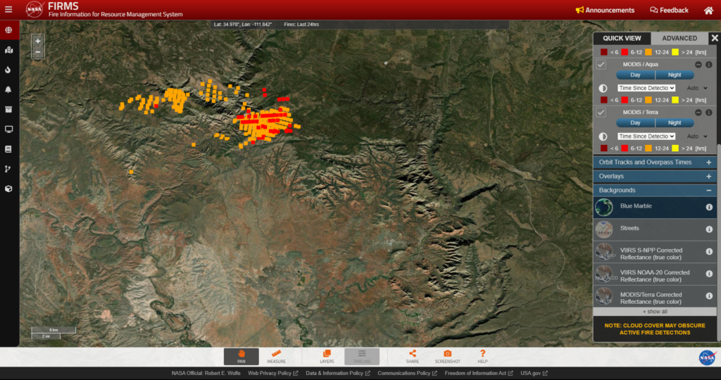
The Fire Information for Resource Management System (FIRMS) distributes Near Real-Time active fire data within 3 hours of satellite observation from the Moderate Resolution Imaging Spectroradiometer aboard the Aqua and Terra satellites, and the Visible Infrared Imaging Radiometer Suite aboard S-NPP and NOAA 20, formally known as JPSS-1.
https://firms.modaps.eosdis.nasa.gov/map
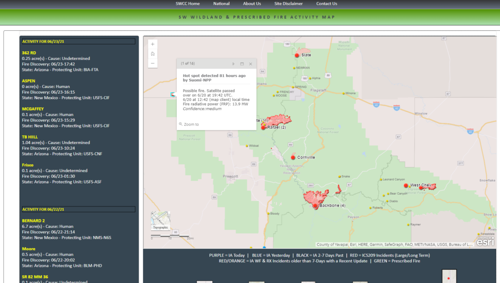
Under the umbrella of the National Interagency Fire Center and the National Wildfire Coordinating Group, the Southwest Coordination Center (SWCC) is an interagency office consisting of personnel from USDI Bureau of Indian Affairs, USDI Bureau of Land Management, USDI National Park Service, USDI Fish & Wildlife Service, and USDA Forest Service. The purpose of the Center is to be the focal point for logistical support (i.e. mobilization and demobilization of resources) between the twelve Dispatch Centers within the Southwest Area, and the National Coordination Center. In addition, the Center provides Predictive Services and Intelligence related products for decision support.
https://bit.ly/35KPPrz
National Wildfire Coordinating Group provides national leadership to enable interoperable wildland fire operations among federal, state, local, tribal, and territorial partners. NWCG was formed in the United States as a result of the aftermath of a major wildfire season in 1970. The 1970 fire season underscored the need for a national set of training and equipment standards which would be standardized across the different agencies. The NWGC was established in 1976 through a Memorandum of Understanding between the Department of Agriculture and the Department of the Interior.
https://maps.nwcg.gov/sa
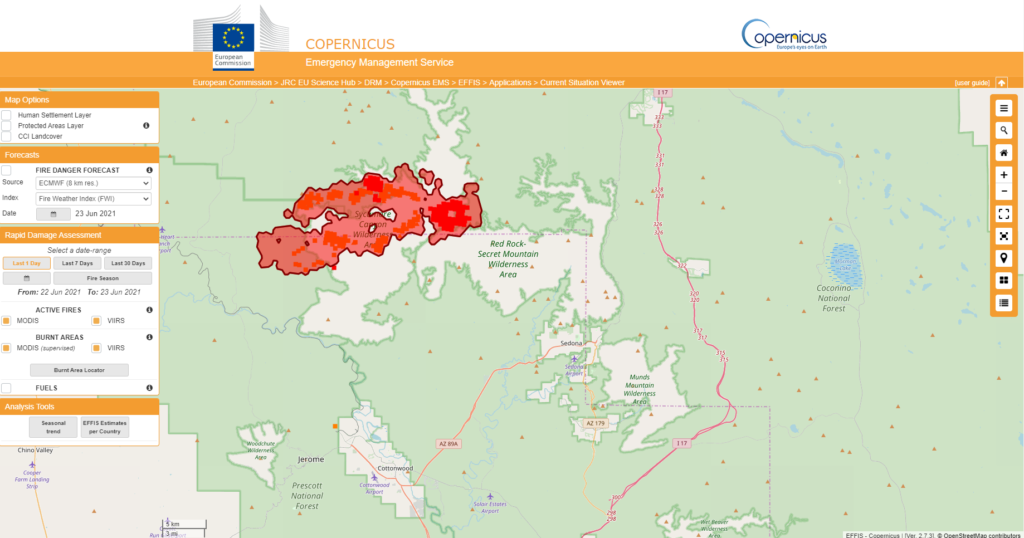
Copernicus Emergency Management Service provides on-demand detailed information for selected emergency situations that arise from natural or man-made disasters anywhere in the world. Copernicus is a European Union program aimed at developing European information services based on satellite Earth Observation and in situ (non space) data. Copernicus is a user-driven program and the information services provided will be freely and openly accessible to its users, mostly public authorities. Although run by the European Union and focused on Europe (you’ll have to move the map to focus on the United States), it has detailed satellite information from around the world.
* Also remember that all distances are measured in kilometers. A mile is 1.60934 kilometers.
https://effis.jrc.ec.europa.eu/apps/effis_current_situation/
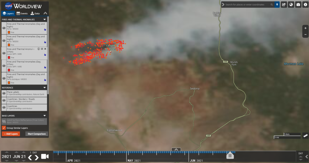
NASA’s Worldview app lets you explore Earth as it looks right now or as it looked a week ago or almost 20 years ago. Through an easy-to-use map interface, you can watch tropical storms developing over the Pacific Ocean; track the movement of icebergs after they calve from glaciers and ice shelves; and see wildfires spread and grow as they burn vegetation in their path. Pan and zoom to your region of the world to see not only what it looks like today, but to investigate changes over time. Worldview’s nighttime lights layers provide a truly unique perspective of our planet.
https://go.nasa.gov/3vUkX2l
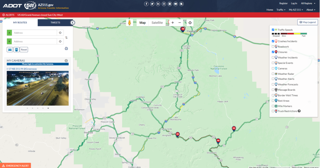
Established in July 2000 by the Federal Communications Commission, 511 is the nationally-designated, three-digit telephone number for traveler information. 511 was created to provide an easy-to-remember number travelers could use to access road and traffic information from within the jurisdiction, such as Arizona, they are traveling. AZ511.gov is maintained and operated by the Arizona Department of Transportation in cooperation with regional, state and local partners.
https://az511.gov/
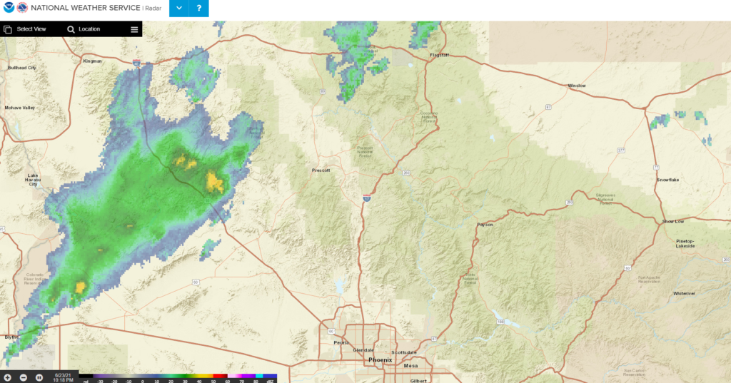
The six National Weather Service regional offices manage all operational and scientific meteorological, hydrologic, and oceanographic programs of the region including observing networks, weather services, forecasting, and climatology and hydrology. They monitor these services and adjust resources to provide the most effective weather and warning services possible. The National Weather Service provides weather, water, and climate data, forecasts and warnings for the protection of life and property and enhancement of the national economy.
https://radar.weather.gov/
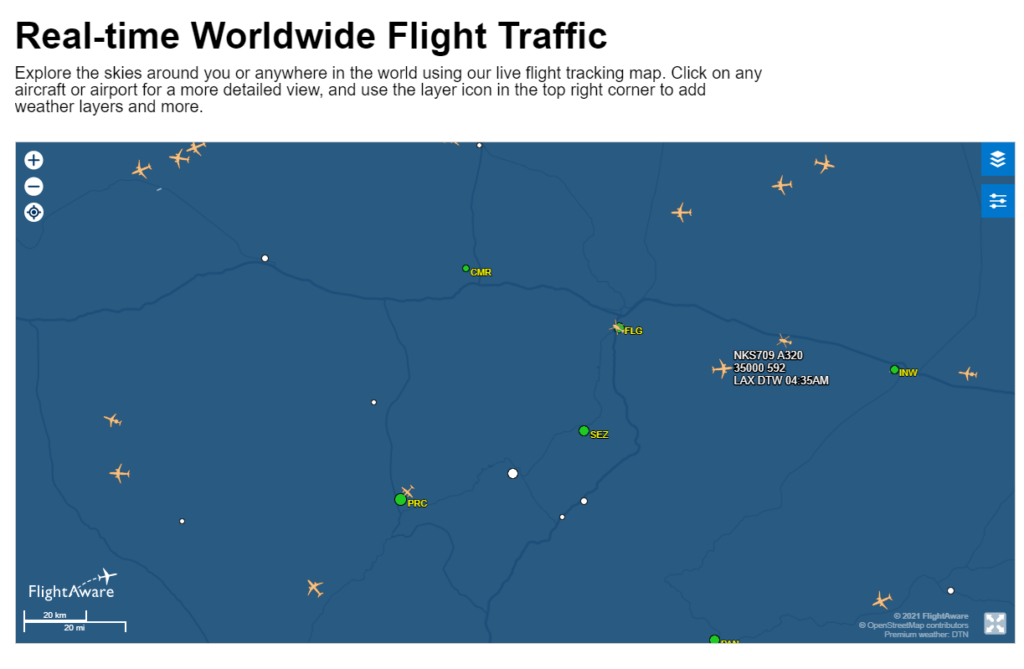
FlightAware is a digital aviation company and operates the world’s largest flight tracking and data platform. It tracks both commerical aircraft and nonmilitary government aircraft, like firefighting helicopters and fixed-wing planes. FlightAware provides over 10,000 aircraft operators and service providers as well as over 13 million passengers with global flight tracking solutions, predictive technology, analytics, and decision-making tools. FlightAware receives data from air traffic control systems in over 45 countries, FlightAware’s network of ADS-B ground stations in 195 countries, Aireon global space-based ADS-B, and datalink (satellite/VHF) via every major provider, including ARINC, SITA, Satcom Direct, Garmin, and Honeywell GoDirect.
https://flightaware.com/
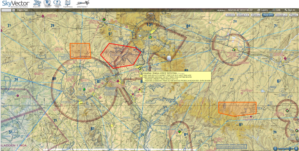
Founded in 2006, SkyVector is a provider of world-wide aeronautical charts, online mapping and related flight planning products and services. SkyVector combines its aeronautical mapping with weather and data overlays, airport information, FBO listings and temporary flight restrictions. It pulls map information from the Federal Aviation Administration.
https://skyvector.com/


